Showing posts with label Trail Projects. Show all posts

1/21/2015

Cuyuna Lakes MTB Crew & MN DNR Unveil Master Plan for Trail Expansion In Cuyuna Country State Recreation Area


On January 8th the Cuyuna Lakes Mountain Bike Crew held their Annual Meeting unveiling the Master Vision for Trails within the Cuyuna Country State Recreation Area in coordination with the MN DNR and Crow Wing County.  This vision is expected to cost around $6 million but the CLMTB Crew estimates that it will bring $21 million of economic impact to the area each year once constructed.


For more details on the Cuyuna Master Vision for Trails visit MN Trails' article Cuyuna Crew Has Mountain Bike Vision.  Watch the video below to see the full Cuyuna Lakes Mountain Bike Crew 2015 Annual Meeting that was streamed live and learn more about the Cuyuna Master Vision for Trails (presentation starts at 55:18).

11/01/2014

Save the Minnesota River Bottoms: Sign the Petition


For those of us that use the Minnesota River Bottoms, whether it be for hiking, running, mountain biking or bird watching, this area has been a favorite of nature lovers during all seasons for many years because of its natural beauty.  I first introduced my son to mountain biking here years ago and it was a special place for us to go and ride together.  For over 20 years MORC members have helped maintain this natural surface trail that runs between the Bloomington Ferry Bridge and Indian Mounds School in Bloomington.


This area is prone to repeated flooding and the idea of millions of dollars being used to develop a paved or aggregate trail here seems like an expensive plan that will require a lot of  yearly maintenance costs and has been one that many people have opposed for years.  Many of us would like to see this area expanded, improved and preserved in its natural state as a natural surface multi-use trail open to hikers, runners, cyclists and nature lovers.  MORC has started a petition that will be presented to the MN DNR, Bloomington City Council and Representative Ann Lenczewski.  Please visit Change.org to let your voice be heard that you want to stop the plan to put a paved trail in the Minnesota River Valley between the Bloomington Ferry Bridge and the Old Cedar Avenue Bridge.

For updates on this important issue please visit the Save the River Bottoms Facebook pageJoin MORC today to help safeguard the future of mountain biking in Minnesota through the promotion of responsible riding, establishment and maintenance of mountain biking trails, and preservation of Minnesota's natural resources.

9/20/2014

MORC's 20th Anniversary Gala To Be Held November 9th


For 20 years MORC's (Minnesota Off-Road Cyclists) mission has been "Gaining and Maintaining Trails" so to celebrate this this anniversary and fellow ridership they are throwing a BIG party.  The MORC 20th Anniversary Gala will be held at the Varsity Theater in Dinkytown November 9th from 2-7pm.

Image Credit: Varsitytheater.org

This formal attire dinner event will raise funds for MORC's 2015 season and their efforts to become the International Mountain Bicycling Association’s first designated ‘Ride City’ which requires a major metropolitan area to have 100+ miles of designated single track mountain bike trail.  MORC is currently developing the Three Rivers Park area at Lake Rebecca which will secure this designation but "it is going to take a lot of blood, sweat, tears and dollars to complete a project of this scope but it is sure to be amazing!"

Silent and live auctions during the Gala will also support MORC's efforts moving forward.  If you are an individual or business that would like to donate items for these auctions, please contact Meghann Charboneau.

Image Credit: Media Logic Group

The evening will feature several speakers during the dinner.  Keynote Speaker, Paul Douglas' talk will incorporate weather/climate with outdoor recreation, namely cycling.  Other speakers scheduled include President of QBP Steve Flagg, former IMBA Midwest Regional Director now with the MN Land Trust Hansi Johnson and Minnesota High School Cycling League Communication Director and Founding Member Libby Hurley.

Image Credit: Minnesota High School Cycling League

MORC Gala Breakdown
2-7pm Event Time 
2-3:30pm: Surly Brewing Happy Hour
3pm: Silent Auction Begins
3:30-5:00pm: Dinner
4:15pm: Keynote Speaker Paul Douglas
4:30pm: Second Speaker Libby Hurley
4:45pm: Third Speaker Steve Flagg
5:00pm: Fourth Speaker Hansi Johnson
5:15-6:15pm: Live Auction
6:15-7:00pm: Music by "The Lost Wheels"
Note: Times and events are subject to change

Valet parking will be available and there is plenty of parking around the Varsity Theater and at the U of M 4th Street ramp.  Tickets are available now through Brown Paper Tickets.  Purchase your tickets before October 1st and save $30.  Your attendance will help fund projects at the Twin Cities mountain bike trails we all love to ride.

7/25/2014

Old Cedar Avenue Bridge Rehabilitation Project is Underway


After many years of discussion, debate and extensive studies, the rehabilitation project for the Old Cedar Avenue Bridge over Long Meadow Lake is finally underway.  Since its closure in 2002 to pedestrian and bike traffic, the old steel truss bridge has been deteriorating and considered an undue safety hazard.


Now that the City of Bloomington has secured Federal and State funding for the rehabilitation project, construction will begin in 2015 and open to cyclists and pedestrians in the Spring of 2016.  A team of  bridge engineers and historians has been hired to consult and develop the final project design plan which will wrap up in November.  Bid letting for the project is expected to take place in December and project commencement in January 2015.


This project has been long awaited by cyclists and will be a very important river crossing not only for bike commuters, but recreational riders and pedestrians alike.  A public meeting on the project was held in June and another will be held this Fall.

For more information about the Old Cedar Avenue Bridge visit the Old Cedar Avenue Bridge over Long Meadow Lake - History Frequently Asked Questions page on the City of Bloomington website.  For a background of the bridge, project status and information on public meetings about the project, visit the Old Cedar Avenue Bridge Over Long Meadow Lake website.   Subscribe to receive email updates on the Old Cedar Avenue Bridge Project.

7/06/2013

Mankato Area Mountain Bikers Offer New Trail Opportunities


The Mankato Area Mountain Bikers (MAMB), the southern Minnesota affiliate of the Minnesota Off-Road Cyclists (MORC) were offered two opportunities by Blue Earth County for the development of new singletrack trails in the Mankato area last fall.  It is MAMB's vision to build sustainable, environmentally friendly trails that make the most of natural terrain features, so members jumped at the chance to develop two new trails.  With the help of members and volunteers, these new trails are ready to ride*.

Fort LeHillier Trail

View Ft. LeHillier Trail in a larger map

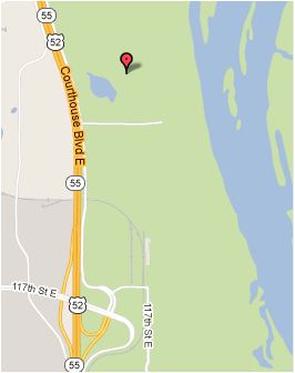
On the southwest corner of the intersection of Co. Rd. 90 and MN Hwy 66 lies a section of land along the Blue Earth River Bottoms, not far from the Mount Kato Ski Area, that contains the Fort LeHillier Trail.  This area was the sight of the old Fort LeHillier built in 1700.  The area has long served as a canoe/boat launch with a large gravel parking lot that makes the small trail system very accessible.

Image Credit:  Clay Haglund

I spoke with MAMB Board Member (also one of the founders), Clay Haglund via email and he told me, "The plot was only a few acres large and we have nearly maxed it out to get approximately a mile and a half of trail.  I have GPS'd 2.1 miles linking up all the options for one full lap which requires re-riding some of the main loop a few times.  The trails are beginner level with some intermediate features mostly on "B" lines.  You will find tight, flowing singletrack with berms, rollers and a few added features like skinnies and a rock garden.  There is only about 40' of elevation change so no sustained climbing.  We didn't know how long we would have to wait for further trail building opportunities so this trail tries to have a little something for everyone and provide an area to practice the kind of skills that are not being addressed by Mankato's other current mountain bike offerings."  For more photos of the trail building efforts of volunteers and members visit the Fort LeHillier Trail Building photo album on their Facebook page.

Below is a great video of the trail from Jeff Hokeness of Mankato.


Trailwork is done on the 2nd and 4th Thursdays of the month at 6:00 pm and updates will be posted on the MAMB Facebook page.

Note*
Recent flooding has caused a closure of the Fort LeHillier Trail.  From the MAMB Facebook page, "Due to all the rain we have had recently causing the high river levels the trail is largely under water and severely damaged. Pictures will follow.  Please stay off the trail until it is dry. We will have updates regarding trail repairs."

Image Credit:  Clay Haglund


Rail Tie Trail


View Rail Tie Trail in a larger map

Image Credit:  MAMB
Not long after construction began on the Fort LeHillier Trail, Blue Earth County approached MAMB and offered them another opportunity to build a small beginner trail in the right of way that runs parallel to the paved Red Jacket Trail.  This short section of singletrack is about a mile long and is easily handled by the most novice of riders.  Visit their Facebook photo album Rail Tie Trail for more pictures of the trail building efforts.


Because of the quality and commitment of the work done by MAMB, local leaders and land managers are taking notice. In my correspondence with Clay, he also stated, "Local leaders in Mankato and Blue Earth county have been impressed enough by our work that we've recently been granted access to a much larger plot of land near the Kiwanis dog park at the junction of Hwy 14 & Hwy 169.  Survey and assessment of the land is underway with planned trail construction to begin late summer or fall.  This area is much larger than Fort LeHillier with a lot of potential for new trails along with a pump track and skills park.  Another project that has been in the works for several years in St. Peter before our club officially formed, is also in the final stages of approval which opens up another 400 acres of river bottom land that might support 10+ miles of trail...so stay tuned...we're just getting started!"

MAMB is a 501.C3 non-profit organization with currently free membership.  To join, "Like" them on Facebook or visit the MAMB website and get involved with rides or volunteering.  "In the future, as our trails expand, we hope to become a chapter of the IMBA which will entail members paying dues; of which a portion will go back into the club's account for trail building needs."


Stay up-to-date on MAMB news by reading the MAMBlog or subscribe via RSS.  For more information on the Mankato Area Mountain Bikers, send an email to join.mamb@gmail.com or call them at 507-327-7170.

5/13/2013

Northern Portions of the Willard Munger State Trail to be Closed for Repairs


If you plan on riding the northern section of the Willard Munger State Trail be aware of trail closures for repairs from the June 2012 flooding to be taking place.  The Minnesota DNR recently sent out a Press Release about the closures.  Redecking of the St. Loius River and Forbay bridges will taking place from a start time in late April lasting approximately 6 weeks resulting in a trail closure from Carlton to Thompson.

In early June a section of the trail in West Duluth will be closed for repairs to flood damaged areas.  The trail between these two sections set for closure will be open for use but there may be some unpaved areas in need of repair.

For more up-to-date trail construction information, visit the Willard Munger State Trail page or call the MN DNR Information Center at 651-296-6157, toll-free 888-646-6367, between 8 a.m. and 4:30 p.m. Monday through Friday.

1/02/2013

Cuyuna Lakes Whiteout Gearing Up to be a Great Event

Last year's lack of snow wasn't enough to halt the first annual Cuyuna Lakes Whiteout and with all of the snow we have had so far this winter, conditions are looking good for this year's event.

The Whiteout this year has a weekend full of events planned.  Friday night, March 1st there will be a pasta feed, a Portsmouth night snowshoe hike and a Yawkey Unit night ride.

Saturday the races commence with Iron Yeti Sagamore Snowxross Race, an 18 mile trek which is part of the Great Lakes Fat Bike Series.  There will be men's and women's classes for beginner, intermediate and expert, so if your new to fatbike racing or have been at it for a while, there is a race class for you.  Then the Serpent Lake Ice Bike Race will be held at the Crosby Memorial Park where you can race your studded tire mountain bike or studded tire fatbike on the ice.  There will be a fun, fatbike drag race out on the ice here too, where riders will go all out for 100 yards to the finish line.  The Crosby Memorial Park will have fatbike demos, music, kids activities and refreshments going on during this time.

For more information on all of the events visit the website.  If you would like to register for the Cuyuna Lakes Whiteout there is an Avalanche Pass that covers all of the events and early bird registration is through January 15th.  A la carte event registration is also available.  Proceeds raised from the event according to the website go to:

50% to cover the costs of Whiteout 2013 
10% to save for Whiteout 2014 
10% to cover our insurance for the Cuyuna Lakes Mountain Bike Crew to maintain our summer singletrack trails (we love those trails!) 
30% to fund our next trail expansion, Yawkey Overdrive!

So sign up, have a good time at the Whiteout and help support the Cuyuna Lakes Mountain Bike Crew, the trails and next year's Cuyuna Lakes Whiteout.

The Cuyuna Lakes Mountain Bike Trails have an interesting history and Aaron Hautala had a chance recently to talk about it and the Cuyuna Lakes Whiteout with Ben Welnak on Mountain Bike Radio.  Aaron breaks down the details of the Whitout as well as the history and upcoming plans for the Cuyuna Lakes Mountain Bike Trails.  Check out the episode on the player below or go to the Blogtalkradio link.


12/03/2012

Bike Trail Picture of the Day - 12/3/12


Riding on the new trail

Taken 12/3/12

Location:  Mississippi River Regional Trail
Pine Bend Bluffs Segment
Pine Bend Bluffs Scientific & Natural Area
Inver Grove Heights, MN

GPS Map Location

11/06/2012

MRRT Update: Pine Bend Bluffs Segment Nearing Completion


Most of the southern half of the Pine Bend Bluffs segment of the Mississippi River Regional Trail has been paved and is nearing completion.  Placing top soil and grading work continue along the sides of the trail in preparation for seeding.  A lot of progress has been made since my last report and the photos below will detail completed work and what is still to be done.  The photos will chronicle the trail from 117th St. E northward to 111th St. E. at intervals to show the full length of this 1.1 mile segment.


Below is the section of trail to still be paved.  This is part of the 300' section I mentioned in the last post that was unclear on the placement and paving of it.


It does appear that it may get paved soon by the markers that are in place.  Fence, edge of trail, guard rail and back of curb markers are place along this section indicating trail placement.


Just past this point is one of two scenic overlooks that provide great views of the river, Baldwin Lake and the Mississippi River Valley.


The next series of photos show the trail as it meanders along the edge of the bluffs and deep wooded ravines.


At this point is the second scenic overlook with a viewing platform off the trail.  This overlook provides the best view of the valley, you can see for miles here.


The trail continues on past the scenic overlook winding through the woods and meeting up with the finished northern half of the Pine Bend Bluffs segment of trail.


I ventured my way back to 117th St. E. and plotted the trail with my phone's GPS to show the course it actually takes.  Below is a screenshot showing the direction and elevation of the trail.


On my way back I encountered these guys.  I'm sure there will be a lot of sightings for those that use the trail with all of the wildlife habitat nearby.  The Pine Bend Bluffs Scientific and Natural Area is one of the most undisturbed areas in the Twin Cities.

Related Posts Plugin for WordPress, Blogger...