Showing posts with label State Trails. Show all posts

9/24/2020

Seven Rail Trails a Short Drive From the Twin Cities for Fall Color Rides


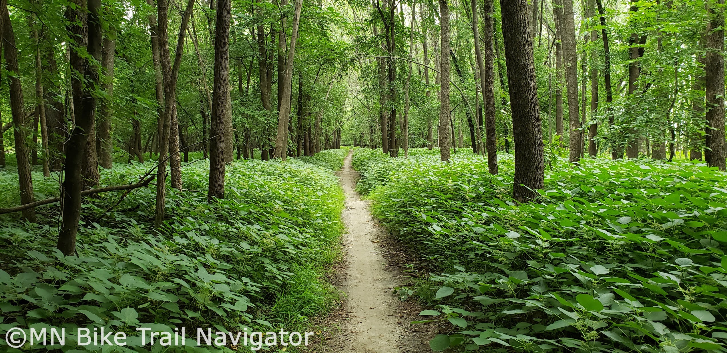
The Fall colors are starting to show and what a better way to see them than on a bicycle.  Minnesota and Western Wisconsin have numerous rail trails within a two hour drive of the Twin Cities that will show you some of the best nature has to offer.  In this post I will list some of the favorites I've ridden, in no particular order, that I found well worth the drive. 

Stower Seven Lakes State Trail


The Stower Seven Lakes State Trail is a 14 mile crushed limestone trail that like the name says, brings riders past seven scenic lakes.  There are plenty of fall colors to see along the way as you pass through woods, wetlands and prairies on this former railroad corridor.  Travelling from Dresser to Amery, this trail also goes through the towns of Nye, Wanderoos and Deronda.  Parking is available near the trail in Amery and on city streets in Wanderoos and Dresser.  There is also parking at Lotus Lake Park in Dresser just 1/3 of a mile down the road from the trail.  

Cyclists age 16 or older need a Wisconsin State Trail Pass while using the trail.  Trail passes can be purchased at self-registration stations in Nye and Amery.  Trail passes are $5 per person a day and $25 per person annually.  A Stower Seven Lakes State Trail map is available online to download and print.

Red Cedar State Trail


The Red Cedar State Trail is a favorite of mine for its scenic beauty as it passes through the Dunnville Barrens Wildlife Area, Lower Chippewa State Natural Area and along the Red Cedar River Valley.  This 14.5 mile crushed limestone former railroad grade travels from Menomonie to the junction of the Chippewa River State Trail just southwest of  Dunnville as it passes through Irvington and Downsville.  Parking is available at the northern trailhead in Menomonie, Irvington, Downsville and at the southern end of the Chippewa River State Trail trailhead in Durand.

Cyclists age 16 or older need a Wisconsin State Trail Pass while using the trail.  Trail passes can be purchased at self-registration stations at the Menomonie depot trailhead, Downsville and in Durand at the trailhead of the Chippewa River State Trail (which leads 7 miles northeast to the trail junction of the Red Cedar State Trail).  Trail passes are $5 per person a day and $25 per person annually.  A Red Cedar State Trail map is available online to download and print.

Cannon Valley Trail 


The Cannon Valley Trail has long been a favorite of cyclists to take in the Fall colors of the Cannon River Valley.  This paved former Chicago Great Western Railroad line will take cyclists 19.7 miles along the south side of the Cannon River past prairies, scenic overlooks, hardwood forests and wetlands between Cannon Falls and Red Wing.  Parking is available on either end of the trail at Red Wing and Cannon Falls as well as the middle of the trail in Welch.  A Wheel Pass is required for any cyclist age 18 and over for $5 a day or $25 for the season.  Wheel Passes can be purchase at self-pay boxes at entry point kiosks in Cannon Falls, Welch and Red Wing, online or at participating business vendors.  A Cannon Valley Trail map is available online to download and print.  There is also an interactive map of the trail online.

Douglas State Trail 


Head south down Highway 52 to Pine Island for a Fall color ride along the Douglas State Trail.  This 12.5 mile paved trail built on a former railroad grade takes cyclists through some amazing rural scenery including the woods and pastures of this agriculturally rich area between Pine Island and Rochester.  Parking is available at the trailheads in Pine Island, Douglas and Rochester.  A Douglas State Trail map is available online to download and print.

Gandy Dancer State Trail-Southern Segment


Take the short trip across the border to St. Croix Falls, WI to view the Fall colors of the Southern Segment of the Gandy Dancer Trail.  This crushed limestone trail takes cyclists 47 miles from St. Croix Falls to Danbury through the towns of Centuria, Milltown, Luck, Frederic, Lewis, Siren and Webster.  The rural scenery and woods along the way make this trail a great choice to take in the Fall colors.  At the end of the trail in Danbury you will find a 520-foot trestle that crosses the St. Croix National Scenic Riverway into Minnesota providing fantastic views of the river valley.  Parking is available in St. Croix Falls, Centuria, Milltown, Frederic, Siren, Webster and Danbury.

Cyclists age 16 or older need a Wisconsin State Trail Pass while using the trail.  Trail passes can be purchased at numerous locations along the trail.  For a complete list of the designated trail pass vendors, visit the Friends of Gandy Dancer State Trail website. Trail passes are $5 per person a day and $25 per person annually.  A Gandy Dancer State Trail-Southern Segment map is available online to download and print.

Chippewa River State Trail

 
The Chippewa River State Trail is part of a group of trails that makes up the Chippewa Valley Trail System which also includes the Red Cedar State Trail and the Old Abe State Trail.  This asphalt/asphalt emulsion trail stretches 30 miles along the Chippewa River from Durand to Eau Claire passing through the towns of Meridean and Caryville and the Dunnville Wildlife Area near the confluence of the Red Cedar and Chippewa Rivers.  The changing habitat includes river bottoms, woods, prairies, bluffs and wetlands making it a great choice to the see the Fall colors by bicycle.  Parking is available at Tarrant Park in Durand, Meridean, Caryville and at Phoenix Park in downtown Eau Claire.

Cyclists age 16 or older need a Wisconsin State Trail Pass while using the trail.  Trail passes can be purchased at a self-registration box in Durand and Eau Claire.  Trail passes are $5 per person a day and $25 per person annually.  A Chippewa River State Trail map is available online to download and print.

Willard Munger State Trail 


Take the short trip north to Hinckley and ride the 70 mile Hinckley-Duluth segment of the Willard Munger State Trail.  This completely paved former railroad route will take cyclists through the cities of Willow River, Moose Lake, Barnum and Carlton on the way to Duluth.  Riders will also experience great Fall colors scenery in the General C.C. Andrews State Forest near Willow River and Jay Cooke State Park near Carlton.  Parking is available at numerous locations along the trail.  A Willard Munger State Trail map is available online to download and print.

7/26/2020

Five Twin Cities Trails to Beat the Heat


The dog days of summer can get pretty hot and steamy in Minnesota but that doesn't have to mean an uncomfortable ride.  The Twin Cities area has quite a few trail systems that run through the cool shade of the woods that I frequent during hot days.  Below I will share some of my favorites to ride to beat the heat.

Brown's Creek State Trail

The Brown's Creek State Trail is a 5.9 mile long rail trail that runs from Grant to Stillwater through a canopy of trees that keeps riders cool on a hot day.  Trail users will parallel Brown's Creek for about two miles and the St. Croix River for another mile as they make their way along this scenic trail.  For those looking to get in some extra mileage, the trail connects to the Gateway State Trail, local trail systems and the newly opened 4.7 mile St. Croix River Crossing Loop Trail.  Parking for the Brown's Creek State Trail can be found in Downtown Stillwater, the Brown's Creek Nature Preserve and under the Gateway State Trail bridge in Grant.

Dakota Rail Regional Trail

The Dakota Rail Trail has been a long time favorite of mine for its scenic ride through woods and along lakes and wetlands.  This 14.84 mile paved trail connects Wayzata with Lake Waconia and extends another 12.5 miles (Carver County segment) to the county line just west of New Germany.  A frequent stop along the trail for me is Cathy Mackenthun's Meats & Deli in St. Bonifacius for a quick lunch and to stock up on some of their award winning smoked meats, bratwurst and jerkey.  Parking is available at numerous locations along the trail making it easy to pick the round trip distance you would like to ride.

Mendota Trail

When I want to get in some dirt riding through the cool of the woods, the Minnesota River Bottoms' Mendota Trail in Fort Snelling State Park is my "go-to" spot.  This trail travels 6 miles along the Minnesota River's south bank from underneath the 77 Bridge in Eagan to the Sibley House Historic Site in Mendota. With connectors like the 494 Bridge, Mendota Bridge, Big Rivers Regional Trail and Minnesota River Greenway, different mileage route options for a multi-surface ride are quite numerous.  Parking can be found in Mendota and underneath the 77 Bridge in Eagan.

Gateway State Trail

The 18 mile Gateway State Trail takes cyclists northeast from St. Paul to Pine Point Park just outside of Stillwater.  With plenty of connections including the Bruce Vento Regional Trail and Brown's Creek State Trail and numerous parking locations along the trail, varying routes can be planned for the mileage you would like to do.  The scenery changes from urban to rural as riders pass lakes, woods and wetlands on the way towards Stillwater.  With plenty of trees along the trail this is one ride that will help you stay cool on those hot summer days.

Lake Minnetonka LRT Regional Trail

The Lake Minnetonka LRT Regional Trail has been a longtime favorite of mine for its scenery as well as shade on hot days.  This 15.92 mile aggregate trail stretches between Hopkins and Carver Park Reserve in Victoria as it passes by Lake Minnetonka and through numerous communities along the way.  Make sure to stop in Excelsior for a pint at Excelsior Brewing or Sebastian Joe's Ice Cream at Tommy's Tonka Trolley on the waterfront.  For those that like a little longer ride, take a trip around Lake Minnetonka by traveling through Carver Park Reserve to St. Bonifacius and jumping onto the Dakota Rail Trail on your way to Wayzata and back to Hopkins.  Parking can be found at numerous locations along the trail but I tend to start near the Depot Coffee House in Hopkins at the junction of the Cedar Lake Trail and the Minnesota River Bluffs LRT Regional Trail.

10/10/2018

Favorite Fall Rides In and Near the Twin Cities-Part 2


Fall is one of my favorite times of the year to ride and right now the leaves in and around the metro are starting to change color.  We have many trails and roads in Minnesota that are perfect for seeing all sights that Fall has to offer by bicycle.  There's something here for every type of cyclist whether you're a mountain biker, trail rider or gravel enthusiast.  Get out there soon as this opportunity comes and goes quickly.   Below are some of my favorites near the Twin Cities that I try to visit this time of year.

Minnesota River Bottoms

The Minnesota River Bottoms network of trails have always been a Fall favorite of mine for riding my fatbike.  The floodplain forest offers great views of the river and wildlife that inhabit this area.  However, with all the rain we have had recently some areas are too soft to ride or are underwater due to flooding.  The Bluffs section between 35W and Mound Springs Park has a high enough elevation where flooding shouldn't be a problem.  Other segments are rideable but there will be some spots that are muddy or under water and you may have to turn back.

The trail conditions in a floodplain are constantly changing so check for updates by visiting the MORC Trail Conditions page or see and hear about other's ride experiences on the MN River Bottoms Ride Report Facebook group.

Cannon Valley Trail/Hay Creek/
Goodhue-Pioneer State Trail

The Cannon Valley Trail is a little over 19 miles long and has trail access in Cannon Falls, Welch and Red Wing.  The trail was built on a former railway grade and offers beautiful views of the Cannon River, woods and prairies along the way.

The ride doesn't have to end in Red Wing.  Hop onto the city trail that follows along Hay Creek and it will lead you to the Goodhue-Pioneer State Trail which also follows Hay Creek with awesome views of  the changing colors as you roll through the Richard J. Dorer Memorial Hardwood State Forest.  Follow the trail until it ends in the little town of Hay Creek which is the turn-around point.  Make a day of it and start at the Cannon Falls Trailhead and ride to the town of Hay Creek for a 52 mile round-trip ride.

Fort Snelling State Park

Fort Snelling State Park has trails to ride through the woods on both sides of the Minnesota River.  Near the historic fort on the north side of the Minnesota River there is plenty of parking and once you head down the hill on the trail near the fort you will come across both paved and unpaved trails on Picnic Island and around Snelling lake.  There is also the paved Minnehaha Trail that follows the Mississippi River north through the woods to Minnehaha Park.


Some of you may be very familiar with the Mendota Trail that follows along the Minnesota River on the south side from Mendota all the way to the Cedar Ave. bridge.  This section of natural treadway trail offers many views of the river as it meanders along through the woods past creeks, lakes and marshes.  With all of the rain we have had recently, some sections of the trail are very wet and/or underwater so keep that in mind.  Updates and photos for this section of trail can be found at the MN River Bottoms Ride Report Facebook group page.

Lilydale/Harriet Island Regional Park

The paved trails that run through Lilydale Regional Park and Harriet Island Regional Park are a joy to ride this time of year.  These trails pass through the floodplain forest along the south side of the Mississippi River from 35E in Lilydale all the way to Harriet Island in St. Paul.  The views of the changing colors along the way are spectacular and it's hard to believe that it's so close to downtown.  These trails also connect in Lilydale to the Big Rivers Regional Trail making for a longer ride along the river and multiple other trail options.  For a better view of the trails in this area, visit Google Maps to plan out your Fall color ride.

Umore Park/Vermillion Highlands

A place I continue to ride year after year in the Fall is close to home for me.  The Vermillion Highlands and UMore Park in Rosemount have paved and gravel roads that take you through part of what used to be the Gopher Works Ordinance plant during World War II and a wildlife management area.  Some of these roads I used to ride have been closed to the public by the University of Minnesota but there are still a lot of areas to see the Fall colors and experience nature.


Explore old paved roads with light car traffic throughout UMore Park on the north side of 160th St. E. and then venture into the Vermillion Highlands on the south side.  Some roads to ride include Station Trail, Annette Ave., 190th St. and Blaine Ave.  Just off of Station Trail is the entrance to Whitetail Woods Regional Park that has a picnic area and restrooms. 


Don't delay as the Fall colors don't stick around for long.  Visit one of the areas mentioned in this post if you haven't before and experience Minnesota Fall on a bicycle.

10/06/2018

Favorite Fall Rides In and Near the Twin Cities-Part 1


Fall is one of my favorite times of the year to ride and right now the leaves in and around the metro are starting to change color.  We have many trails and roads in Minnesota that are perfect for seeing all sights that Fall has to offer by bicycle.  There's something here for every type of cyclist whether you're a mountain biker, trail rider or gravel enthusiast.  Get out there soon as this opportunity comes and goes quickly.   Below are some of my favorites near the Twin Cities that I try to visit this time of year.

Lebanon Hills

One very popular spot for mountain bikers in the Twin Cities is Lebanon Hills Mountain Bike Trails.  With the majority of the trails in a hardwood forest, this is a prime spot to ride right among the changing colors.  Lebanon Hills has over 12 miles of beginner to expert level trails making it a great ride for mountain bikers of all abilities.  Fall's wet weather does present some challenges though so make sure the trails are open before heading out to there for a ride. Visit the Lebanon Hills Mountain Bike Trail Facebook page or the MORC Trail Conditions page for the latest updates on trail conditions and closings.

Minnesota River Bluffs LRT Regional Trail

The Minnesota River Bluffs LRT Regional Trail is a 12 mile long aggregate trail that runs from Hopkins to Chaska.  It passes through several parks and offers great views of the changing colors around the Minnesota River Valley.  A portion of the trail is closed between Pioneer Trail in Eden Prairie and Highway 101 in Chanhassen due to trail washout from mudslides in 2014 so plan your ride here accordingly and follow the posted detour.

Big Rivers Regional Trail

The Big Rivers Regional Trail in Dakota County is only 4 1/2 miles long but offers great views of the river valley at the confluence of the Minnesota and Mississippi Rivers.  Trail access is available at the East Trailhead on Lilydale Rd. in St. Paul and along Hwy. 13 at I-494, Pilot Knob Rd., Hwy. 55 and I-35E.  The Big Rivers Regional Trail also links to many other area bikeways along both sides of the Mississippi and Minnesota Rivers.  Visit Google Maps to plan out your ride in this beautiful river valley area and make a day of it.

Mississippi River Regional Trail-Dakota County

The south/east segment of the Mississippi River Regional Trail in Dakota County is one of my favorite new trails to ride for great views of the Mississippi River Valley and the hardwood forest that surrounds it.  Access to this part of the trail is available at the Lower Spring Lake Park Reserve Trailhead/West Trailhead, the Schaar's Bluff Trailhead and the Lock and Dame No. 2 Trailhead.  This segment of trail also continues on to the city of Hastings.

For a longer ride, I like to start in Hastings at Levee Park and follow the trail past Lock and Dam No. 2 all the way to the Lower Spring Lake Park Reserve Trailhead/West Trailhead and back for a 21 mile round-trip ride.  A map of this segment of trail can be found here.

Welch Gravel

The Cannon River Valley in and around Welch is a favorite of mine for riding gravel this time of year.  With deep ravines, big climbs, fast downhills and magnificent scenery along the way, this area showcases the Fall colors at their best.  I have returned to this area many times since I first got into gravel back in 2013 and some of these roads are part of the Miesville 56 course which is a gravel rider's favorite.

I have two routes that I like to ride in this area, one on the north side of the Cannon River and one on the south side.  Both of these rides start at the Welch Station on the Cannon Valley Trail.  The Welch-North Loop is a 16 mile ride that is just under 1,000 feet of climbing and the Welch-South Loop is also 16 miles with just over 750 feet of climbing.  Do both loops together for a longer ride, more climbing and plenty of great views that the Cannon River Valley has to offer.  Try mixing it up and doing these routes in reverse for a completely different ride.


Don't delay as the Fall colors don't stick around for long.  Visit one of the areas mentioned in this post if you haven't before and experience Minnesota Fall on a bicycle.  I will add five more of my favorite Fall rides soon in a second segment of this post.

3/31/2017

Three Trail Grand Openings Set for this Spring

Two existing trails and one new one have some new mileage that will have Grand Opening celebrations later this Spring.

Mississippi River Regional Trail
Image Credit: Dakota County Parks

Dakota County Parks will hold the Mississippi River Trail Grand Opening on Saturday, May 20th from 9am to noon at Spring Lake Park Reserve/Schaar's Bluff in Hastings.  This newly completed 4.3 mile section is now open and contains three overlooks and two bridges spanning a total of approximately 570 feet with overlook decks on each.  Visit Dakota County Parks' Trail Construction page and the Project Overview Map page for more information about the trail.

Mill Towns State Trail
Image Credit: Dakota County Parks

Another new segment of trail made possible with cooperation from Dakota County Parks, Goodhue County and the Minnesota DNR is the part of the Mill Towns State Trail in Cannon Falls.  The Mill Towns State Trail Grand Opening takes place Saturday, June 3rd from 2 to 5pm.  "Festivities will include activity stations along the trail, naturalist programs, refreshments and a community bike ride. More information to come soon."
 
Minnesota River Greenway

The Minnesota River Greenway was made possible by Dakota County, the City of Burnsville, U.S. Fish and Wildlife Service, and Xcel Energy.  This new stretch of trail runs from HWY 77 to 35W (3.5 miles) along the south side of the Minnesota River.  The Minnesota River Greenway Grand Opening celebration is on Saturday, June 3rd from 10am to noon with a ribbon cutting ceremony at 10:15am.  The Grand Opening will be held at Minnesota Riverfront Park in Burnsville.  "Festivities will include activity stations along the trail, naturalist programs, refreshments and free bikes available for check-out."

10/03/2016

The MN DNR Wants Your Input for Year Three of its Winter Fat Bike Pilot Project

Fort Snelling State Park Muli-use Trail
 
The Minnesota DNR has just set up an online survey to get feedback from fatbikers and specifically, those that have used the Fat Bike Pilot Program trails over the past two years.  The 21 question survey was designed to help the MN DNR improve upon the existing Winter Fat Bike Pilot Program trails and, who knows, with a very large response to this survey, maybe even add some new Winter fatbike destinations around the state.

Yawkey Unit at Cuyuna Country State Recreation Area

Please take the time to participate in the survey and share with your fatbike friends so they can do the same.  More fat bike trail access is what the MN DNR must be considering after the huge success of the Cuyuna Mountain Bike Trails and other trail systems in the previous year's pilot programs. This is your opportunity to tell the MN DNR what you think about the pilot program trails you have ridden and how they can make the experience better.

Cuyuna Lakes State Trail

I rode some of these trails last winter and it is nice to be able to give some in-detail feedback on what I liked and what I thought needed improvement.  Let the MN DNR know what your thoughts are and help expand and improve their efforts for fatbike trail access around Minnesota.

4/06/2016

Resources for Planning a Minnesota Summer Biking Vacation


Summer is just around the corner and now is the time to start planning your Summer biking vacation(s).  With so many biking destinations around our great state you may want to get more information to help you decide where to go and where to stay.  There are so many resources available at your fingertips that planning your trip has become easier than ever.  Cities and regions around Minnesota are competing for your travel dollars this summer and they have made it easy to find more information about their destinations to attract you.


Minnesota has a lot to offer cyclists whether your discipline is road cycling, mountain biking, gravel, trail or bikepacking.  A great place to start is the Explore Minnesota website.  There is a lot of information here to help you plan the kind of rides you would like to take.  It contains an array of brochures that you can download, view online or have mailed to you.  Quite a few free regional brochures are listed for all areas of the state that can also be selected for mailing.  Go to the Explore Minnesota Travel Guides page to access these brochures.  There are also planning tools beyond just the website, Explore Minnesota Tourism staffs a travel information center with travel counselors that will help you with customized information (by phone, mail or e-mail) for planning your trip.

The 2015-16 Pedal MN Minnesota Biking Guide is another great place to start.  This free publication is available to view online, download or have mailed to you.  It is full of information on paved trails, on-road touring and mountain biking around the state.  It also contains links to trail maps, events and biking destination areas.  Another useful source of Minnesota cycling information is the Pedal Minnesota website that is filled with upcoming events, places to ride, trail information and trip planning resources.


If you have a destination in mind for your trip, try heading to the tourism or visitor's bureau website for that area or city.  Sites like Visit Duluth, Iron Range Tourism, Cuyuna Lake Chamber of Commerce and Root River Trail Towns are full of information that will help you find lodging, dining, attractions, events and area trails.  You may also visit my MN Tourism Resources page for a huge listing of online resources throughout the state.


The Minnesota DNR website contains all sorts of information on biking including State Trails, State Parks & Recreation Areas, State Forests, camping/lodging and other biking opportunities.  If you're looking to get off the beaten path, do some bikepacking or ride somewhere with great scenery, the DNR website is a great choice to get you started.


Summer is right around the corner, so use the wealth of information available on the Internet to make planning your next biking trip a breeze.  For easy to find trail maps and trail information for the Twin Cities Area, Southern MN, Central MN and Northern MN, don't forget about MN Bike Trail Navigator.  I have already done the research to find the links so you don't have to.

12/13/2015

Singletrack Alternatives to Continue Riding During Freeze/Thaw Periods


The unusually warm December weather we are experiencing has put us in a freeze/thaw cycle closing many of the singletrack trails around the state.  To keep the legs fresh and still get some miles in the saddle on a regular basis I have put together some places to ride until the snow comes offering us some groomed singletrack.

Gravel

If it's one thing Minnesota has plenty of it's gravel.  With an ever growing list of gravel rides and races throughout the year, you're sure to have plenty of route options following one of these courses. If you're new to gravel, Gravelmap.com will help you find roads to ride.  I have also posted some of my favorite gravel rides on MN Bike Trail Navigator complete with maps, cue sheets, gpx file download links and Strava route links.  Gravel never closes and is a great way to get in some miles with varied terrain and climbing.

Aggregate Trails

Minnesota has several aggregate trails that are similar to riding gravel.  Most are built on former railway beds so there won't be much elevation change but they will allow you to get in some miles, none the less.  Some of these include the Luce Line State Trail, Minnesota River Bluffs LRT Regional Trail, Lake Minnetonka LRT Regional Trail.

State Trails

Several of Minnesota's State Trails have a natural surface treadway suitable for horseback riding or mtb/fatbike use.  If sharing the trail with horseback riders please use proper trail etiquette.  These trails include:

 
River Bottoms Bushwacking

River bottoms floodplains have some great riding opportunities.  Two of the areas I have done some "bushwacking" are the Vermillion River Bottoms and the Minnesota River Bottoms.  Bushwacking is riding through areas where there is no trail and river bottoms floodplains are a great place to do this.  Fall and early Winter are great times to ride these areas of flat wooded expanses.


The Mississippi National River & Recreation Area near Ravenna TWP southeast of Hastings along the Vermillion River is definitely worth exploring.  The Minnesota River Bottoms is also a good place to roll through floodplain forests and fields.  Respect the area you ride and remember to leave no trace.

Forest Service/Logging Roads
Image Credit: Joe Sacco

The Chippewa National Forest and Superior National Forest have plenty of Forest Service roads, logging roads and unpaved trails with some beautiful scenery to be explored.  Some of these areas are remote so make sure you have everything you need to get you out of a jam and back to where you started.


State Forests
Image Credit: Joe Sacco

Minnesota State Forests are also full of riding opportunities.  These opportunities include non-motorized trails, multi-use trails, State Forest roads, Minimum Maintenance Forest Roads and OHV/ATV trails.  Below are links to maps and more information on these State Forests.

Southern MN State Forests


Central MN State Forests

Northern MN State Forests
Pillsbury State Forest     Map       

The Minnesota DNR reminds you, when biking in State Forests:
  • Mountain biking is permitted on all state forest roads and trails unless posted closed with the exception of Richard J. Dorer Memorial Hardwood State forest, where mountain bikes are permitted only on designated trails.
  • State forest roads can range from asphalt to gravel, maintained to minimal maintenance road surfaces.
  • Forest roads are used by cars, logging trucks, and other forest users (hikers, hunters, horseback riders, ATVs, and off-highway motorcycles).
  • All laws for public road use must be followed on state forest roads.
  • Watch out for logging trucks and heavy equipment in a state forest.
  • Check the state forest maps and Web site for road and trail closures.
  • Share the trail with others.
  • Stay on designated trails.
  • Keep right so others can pass.
  • Keep all pets on leash.
  • Obey traffic signs and rules.
  • Pack out all garbage and litter.
  • Respect adjoining landowners’ rights and privacy.
  • Warn other trail users when passing by giving an audible signal.
  • Let horses know you are passing. Some may be spooked by quiet bikers or inline skaters.
  • Overnight camping and campfires are permitted only on designated campsites.
  • Do not leave campfires unattended.
  • Enjoy the beauty of wild plants and animals, but leave them undisturbed for all to enjoy.
For more information on mountain biking in Minnesota State Forests, see my post, Explore Minnesota's State Forests by Mountain Bike With Resources From the MN DNR.

To order a State Forest map, contact the Minnesota DNR Information Center.

Phone:  651-296-6157 or 888-646-6367
Email:   info.dnr@state.mn.us
Address:  500 Lafayette Road
St. Paul, MN 55155-4040

Paved Trails

Paved trails are always open and many of them in Minnesota have some great scenery.  For a list of trails throughout the state of Minnesota with links to more information and maps visit the appropriate MN Bike Trail Navigator trail links page for your area.


MN Fatbike Enthusiast Recommendations 

I received several recommendations from MN Fatbike Enthusiasts Facebook Group members when posed with this question "...places to ride for mountain bikers/fat bikers during this freeze/thaw period that we are in. With the trails closed, where are you guys riding to get miles in?

"7 mile creek park in Nicollet county...located off Hwy 169 between Mankato and St. Peter. Their multi-use trails have gravel and are always open." - Clay Haglund

"Road bike on the trackstand, and fat-bike at Wayside Prairie and Dalbo Memorial Forest County Parks. Both dry off quickly after rain do to heavy pine cover." - Hans Erdman

"The MRT trails in St. Paul along the river. I've been doing lots of 'urban exploring'. I've also ridden some gravel out towards Rosemount." - Tony Lema

"All early morning rides...... Forest road/woods/mining areas, frozen gravel. Paved trails..... anywhere but established sweat earned single track goodness.... that will come next week!!" - Joe Sacco

"Gateway Trail heading towards Pine Point park (don't ride in Pine Point). Lots of horse trail and singletrack there . All sand and good water wicking dirt and back." - Papito Gregorio

"Soo Line Recreation Trails in Central MN. (Approxiately 50 miles one way of trail). Lots of minimum maintenence roads that connect to these trails. Several county parks, forests, and some state trails. Check out Stearns County Recreational Trails for a list of fat bike friendly locations. I would suggest get a hold of your local bike shops, trail advocates, and bike clubs for a complete list of fat bike friendly routes. Then there is lots and lots of gravel roads winding through the country side. Several turn into minimum maintenance roads. Get up to Central MN and "get your fat on"." - Theresa Gregory

Hopefully this post will give you some ideas of where to ride so you can keep getting miles of riding enjoyment in until the singletrack trails open once we get some snow and below freezing temperatures.
Related Posts Plugin for WordPress, Blogger...