Showing posts with label Forest Roads. Show all posts

12/13/2015

Singletrack Alternatives to Continue Riding During Freeze/Thaw Periods


The unusually warm December weather we are experiencing has put us in a freeze/thaw cycle closing many of the singletrack trails around the state.  To keep the legs fresh and still get some miles in the saddle on a regular basis I have put together some places to ride until the snow comes offering us some groomed singletrack.

Gravel

If it's one thing Minnesota has plenty of it's gravel.  With an ever growing list of gravel rides and races throughout the year, you're sure to have plenty of route options following one of these courses. If you're new to gravel, Gravelmap.com will help you find roads to ride.  I have also posted some of my favorite gravel rides on MN Bike Trail Navigator complete with maps, cue sheets, gpx file download links and Strava route links.  Gravel never closes and is a great way to get in some miles with varied terrain and climbing.

Aggregate Trails

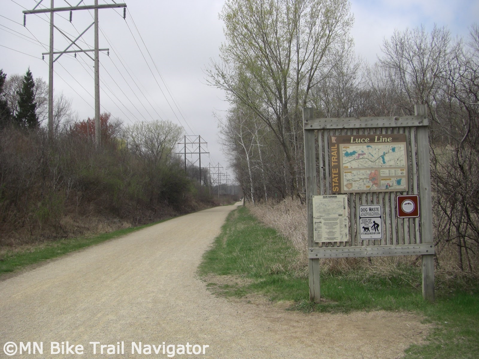
Minnesota has several aggregate trails that are similar to riding gravel.  Most are built on former railway beds so there won't be much elevation change but they will allow you to get in some miles, none the less.  Some of these include the Luce Line State Trail, Minnesota River Bluffs LRT Regional Trail, Lake Minnetonka LRT Regional Trail.

State Trails

Several of Minnesota's State Trails have a natural surface treadway suitable for horseback riding or mtb/fatbike use.  If sharing the trail with horseback riders please use proper trail etiquette.  These trails include:

 
River Bottoms Bushwacking

River bottoms floodplains have some great riding opportunities.  Two of the areas I have done some "bushwacking" are the Vermillion River Bottoms and the Minnesota River Bottoms.  Bushwacking is riding through areas where there is no trail and river bottoms floodplains are a great place to do this.  Fall and early Winter are great times to ride these areas of flat wooded expanses.


The Mississippi National River & Recreation Area near Ravenna TWP southeast of Hastings along the Vermillion River is definitely worth exploring.  The Minnesota River Bottoms is also a good place to roll through floodplain forests and fields.  Respect the area you ride and remember to leave no trace.

Forest Service/Logging Roads
Image Credit: Joe Sacco

The Chippewa National Forest and Superior National Forest have plenty of Forest Service roads, logging roads and unpaved trails with some beautiful scenery to be explored.  Some of these areas are remote so make sure you have everything you need to get you out of a jam and back to where you started.


State Forests
Image Credit: Joe Sacco

Minnesota State Forests are also full of riding opportunities.  These opportunities include non-motorized trails, multi-use trails, State Forest roads, Minimum Maintenance Forest Roads and OHV/ATV trails.  Below are links to maps and more information on these State Forests.

Southern MN State Forests


Central MN State Forests

Northern MN State Forests
Pillsbury State Forest     Map       

The Minnesota DNR reminds you, when biking in State Forests:
  • Mountain biking is permitted on all state forest roads and trails unless posted closed with the exception of Richard J. Dorer Memorial Hardwood State forest, where mountain bikes are permitted only on designated trails.
  • State forest roads can range from asphalt to gravel, maintained to minimal maintenance road surfaces.
  • Forest roads are used by cars, logging trucks, and other forest users (hikers, hunters, horseback riders, ATVs, and off-highway motorcycles).
  • All laws for public road use must be followed on state forest roads.
  • Watch out for logging trucks and heavy equipment in a state forest.
  • Check the state forest maps and Web site for road and trail closures.
  • Share the trail with others.
  • Stay on designated trails.
  • Keep right so others can pass.
  • Keep all pets on leash.
  • Obey traffic signs and rules.
  • Pack out all garbage and litter.
  • Respect adjoining landowners’ rights and privacy.
  • Warn other trail users when passing by giving an audible signal.
  • Let horses know you are passing. Some may be spooked by quiet bikers or inline skaters.
  • Overnight camping and campfires are permitted only on designated campsites.
  • Do not leave campfires unattended.
  • Enjoy the beauty of wild plants and animals, but leave them undisturbed for all to enjoy.
For more information on mountain biking in Minnesota State Forests, see my post, Explore Minnesota's State Forests by Mountain Bike With Resources From the MN DNR.

To order a State Forest map, contact the Minnesota DNR Information Center.

Phone:  651-296-6157 or 888-646-6367
Email:   info.dnr@state.mn.us
Address:  500 Lafayette Road
St. Paul, MN 55155-4040

Paved Trails

Paved trails are always open and many of them in Minnesota have some great scenery.  For a list of trails throughout the state of Minnesota with links to more information and maps visit the appropriate MN Bike Trail Navigator trail links page for your area.


MN Fatbike Enthusiast Recommendations 

I received several recommendations from MN Fatbike Enthusiasts Facebook Group members when posed with this question "...places to ride for mountain bikers/fat bikers during this freeze/thaw period that we are in. With the trails closed, where are you guys riding to get miles in?

"7 mile creek park in Nicollet county...located off Hwy 169 between Mankato and St. Peter. Their multi-use trails have gravel and are always open." - Clay Haglund

"Road bike on the trackstand, and fat-bike at Wayside Prairie and Dalbo Memorial Forest County Parks. Both dry off quickly after rain do to heavy pine cover." - Hans Erdman

"The MRT trails in St. Paul along the river. I've been doing lots of 'urban exploring'. I've also ridden some gravel out towards Rosemount." - Tony Lema

"All early morning rides...... Forest road/woods/mining areas, frozen gravel. Paved trails..... anywhere but established sweat earned single track goodness.... that will come next week!!" - Joe Sacco

"Gateway Trail heading towards Pine Point park (don't ride in Pine Point). Lots of horse trail and singletrack there . All sand and good water wicking dirt and back." - Papito Gregorio

"Soo Line Recreation Trails in Central MN. (Approxiately 50 miles one way of trail). Lots of minimum maintenence roads that connect to these trails. Several county parks, forests, and some state trails. Check out Stearns County Recreational Trails for a list of fat bike friendly locations. I would suggest get a hold of your local bike shops, trail advocates, and bike clubs for a complete list of fat bike friendly routes. Then there is lots and lots of gravel roads winding through the country side. Several turn into minimum maintenance roads. Get up to Central MN and "get your fat on"." - Theresa Gregory

Hopefully this post will give you some ideas of where to ride so you can keep getting miles of riding enjoyment in until the singletrack trails open once we get some snow and below freezing temperatures.

4/23/2014

Gravelmap Launches Interactive User Submitted Gravel Route Database

http://gravelmap.com

Gravelmap is a new website that launched on April 1st and comes to us from a web developer/cyclist from southern Oregon.  After first learning of Gravelmap, I saw huge potential for this budding new resource and decided to get in touch with the site's creator to learn more about it and to give a little feedback about its current features.

Theo responded filling me in on all of the details of Gravelmap and even implemented several of my suggestions to make the site better and even more user friendly.  He proceeded to tell me, "Last year, I acquired an interest in "gravel grinding," as many others have done. Here in Oregon we have lots of gravel, but finding it can be a challenge. Though the roads are plentiful (BLM/USFS roads, logging roads, etc.), when planning a route using Google Maps or topographic maps, it's not always clear if a road is accessible, legal to access, traversable by bike -- or if it even exists. As I explored, I found many great roads, not to mention a few dead ends here and there. But, more than that, I began to contemplate the idea of a resource to help other cyclists find the roads I was enjoying. As more and more people acquired cross bikes and began searching for gravel, I began to hear the same question from friends on Facebook and elsewhere: 'Does anyone know where the gravel roads are?'"


"While out on a ride about a month ago, I had the idea to build a site that would allow users to "draw" and save routes over a live map. Google Maps offers a very powerful interface for extending and adding to its functionality, and the fact that I had worked with it before made it an easy choice to use as the basis for the tool. I spent a series of late nights and a weekend or two building the route mapping engine (the components that make it possible to click, drag, and delete points on the map to create a route), followed by the pieces surrounding it -- the database on the back end, site pages, user login/registration functions, and so on. Eventually I had something that was bare-bones but functional, and I leased a hosting account and launched the site on April 1." 

Because Gravelmap is so new the route database is very limited, but that's where you come in.  Your added gravel routes will be extremely beneficial to the growth and usefulness of this great new resource.

"Most people who find the site simply want to know where the gravel is in their area, and new routes will help make that happen.  My sole intent in building the site is to help share the passion that I have for gravel and backroads cycling. I check the stats and the route database multiple times per day and I get genuinely excited when I see new signups or new routes added -- it feels great to know that people are participating."  


I am always looking for new gravel roads to ride and Gravelmap now allows me to find other user's routes in my area and I can share mine.  Getting started is easy, simply click "Log in" on the top navbar and sign up instantly using Facebook or create a user name and enter an email address with a password.  That's it, you're ready to start sharing your routes, voting on routes and leaving comments on routes you've tried.


Using Gravelmap is easy, visit the Gravelmap Help page for an overview of how to browse the map, add your first route and to see what the guidelines are for adding routes.  Once you have added a route to the Gravelmap database or found a route you would like to try, click anywhere on the route to display more details including:
  • Description 
  • Overlapping routes
  • Elevation profile (including reverse direction, if desired) 
  • Export a GPX file for the route
  • Vote on the route
  • Leave a comment
  • Embeddable route profile (copy and paste a HTML snippet to display a route on a webpage or blog)


Future plans for Gravelmap include user profile pages (click on a user's name to see the other routes they've created) and route editing.  Gravelmap is also compatible with Android devices and is iPhone friendly.  Images below are from an Android phone.


Sign up today to be a part of this fledgling resource and help with the growth of its interactive database of gravel/dirt roads and paths.  After getting to know Gravelmap you may find a bug or have an idea to make the site even better, feedback is welcomed from the developer.  Visit the Feedback page to voice your ideas or problems.  For more information, news, terms & conditions and privacy policy, visit the About Gravelmap page.  Follow Gravelmap on Twitter (@Gravelmap) or "Like" on Facebook.

7/20/2013

Explore Minnesota's State Forests by Mountain Bike With Resources From the MN DNR

Image Credit:  MN DNR
The Minnesota Department of Natural Resources has recently put up a new page on their website that directs cyclists to more information about the great mountain biking opportunities in Minnesota's State Forests.  These include over 2000 miles of forest roads and thousands of logging trails to explore.  The Mountain Biking in Minnesota State Forests page has information about what you need to know before you go, including links to Temporary State Forest Road Closures (updated weekly on Thursday after 2 p.m.), safety information, trail and road usage rules and State Forest Camping

At the bottom of the Mountain Biking in Minnesota State Forest page is a list of  State Forests that allow mountain biking, broken down by region.  Clicking on any of these links will take you to that State Forest's page and provide more details about location, trails, facilities and there is a link to a printable State Forest map showing trails and forest roads.

The Minnesota DNR reminds you, when biking in State Forests:
  • Mountain biking is permitted on all state forest roads and trails unless posted closed with the exception of Richard J. Dorer Memorial Hardwood State forest, where mountain bikes are permitted only on designated trails.
  • State forest roads can range from asphalt to gravel, maintained to minimal maintenance road surfaces.
  • Forest roads are used by cars, logging trucks, and other forest users (hikers, hunters, horseback riders, ATVs, and off-highway motorcycles).
  • All laws for public road use must be followed on state forest roads.
  • Watch out for logging trucks and heavy equipment in a state forest.
  • Check the state forest maps and Web site for road and trail closures.
  • Share the trail with others.
  • Stay on designated trails.
  • Keep right so others can pass.
  • Keep all pets on leash.
  • Obey traffic signs and rules.
  • Pack out all garbage and litter.
  • Respect adjoining landowners’ rights and privacy.
  • Warn other trail users when passing by giving an audible signal.
  • Let horses know you are passing. Some may be spooked by quiet bikers or inline skaters.
  • Overnight camping and campfires are permitted only on designated campsites.
  • Do not leave campfires unattended.
  • Enjoy the beauty of wild plants and animals, but leave them undisturbed for all to enjoy.

Thanks to the Minnesota Department of Natural Resources for making this information easily accessible so we may explore the beauty of our State Forests by bike.

Click here for a complete printable listing of  Minnesota State Forest mountain biking opportunities.  To order a State Forest map, contact the Minnesota DNR Information Center.

Phone:  651-296-6157 or 888-646-6367
Email:   info.dnr@state.mn.us
Address:  500 Lafayette Road
St. Paul, MN 55155-4040
Related Posts Plugin for WordPress, Blogger...