7/27/2013

Get the Most Out of Your Nice Ride MN Experience With Spotcycle


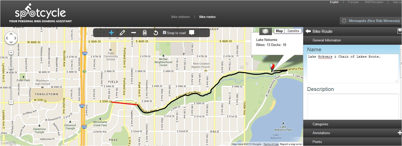
Spotcycle is a convenient and useful app created by 8D Technologies for the purpose of  locating bike stations and bike & dock availability of bike share systems for 26 cities in the U.S. and 7 countries.  It can even be used to create and share personalized bike routes or search for routes created by other Spotcycle users.


Here in the Twin Cities the Spotcycle app works great with our own bike share system, Nice Ride MN.   Nice Ride bikes are available for use 24 hours a day, 7 days a week from April to November with numerous locations scattered throughout the Twin Cities.  A subscription is required to use Nice Ride and they are available yearly for $65 and daily for $6.  Trip charges do occur if you use the bikes more than a half an hour, but with so many bike stations around town it's easy to stay under thirty minutes and incur no trip fees.  For more details on how Nice Ride MN works, click hereSign up for Nice Ride MN today and get rolling.


Spotcycle is easy to set up, simply select a city and it will show all of the bike stations for your area either on a map or a list.


In the list display, stations can be sorted alphabetically, by number of bikes or docks available or by distance from your location. Select from All, Bike or Dock for for station availability information.  Switch to map view by selecting the map icon.


Search for stations that are nearby and list them alphabetically, by bikes available, docks available or by distance from your current location.  If you know the station name you can search by station.  A map view is available by selecting the map icon.


Frequently used stations can be grouped in Favorites for quick access.


View a favorite in list or map display by selecting that group.


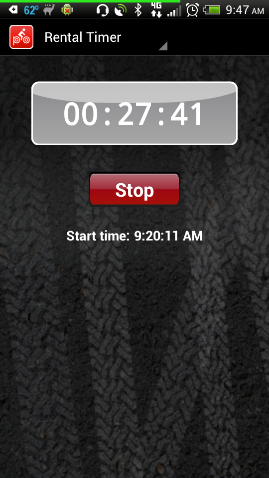
Once you are ready to ride, keep track of your use time using the rental timer.

Track and share your routes via Facebook, Twitter or email.  Keep your routes private if you choose or edit and share them later.  Annotations can be added along the way easily while tracking your route.


Other Spotcycle user routes can be searched by Top Rated, Top Viewed, Browse By Category or Search Routes and bookmarked for later use.  One route I found particularly interesting was the "Minneapolis Original Garage Band" route.


All the features of the Spotcycle app can be accessed by computer by registering and signing in to your Spotcycle account.  Route creation and editing can also be done from your computer.


If you are a current Nice Ride subscriber or are thinking about becoming one, the Spotcycle app will definitely be a handy companion to enhance your Nice Ride experience.  Spotcycle is a free app and is available for Android, iPhone and Blackberry.  For questions about using the Spotcycle app, visit the Spotcycle FAQ page

Stay up-to-date with Spotcycle by reading the Spotcycle Blog, following on Twitter or "Like" on Facebook.

*Note:  All app screenshots in this post are from the Android app.  

7/25/2013

Second Open Streets Minneapolis Heads to Central Ave. N.E.


Open Streets MPLS continues this Sunday with their second Open Streets event on Central Ave. N.E. July  28th.  Open Streets MPLS is an initiative of the Minneapolis Bicycle Coalition and is based on the weekly CiclovĂ­a of Bogotá, Colombia where city streets are closed to automobile traffic in favor of cyclists, pedestrians, skaters and any other form of non-motorized transportation.  This is a free event that will have a variety of activities for the whole family including Zumba, yoga, games, music and shopping at local businesses.  With the success of two Open Streets events last year, 2013 will bring the fun to four Minneapolis neighborhoods.

Open Streets MPLS-Central Ave. N.E.

View Open Streets - Central Avenue NE in a larger map  

Get out the bikes and bring the whole family for a day of fun free from automobile traffic.  The festivities start at 10:00 am and last until 4:00 pm on Central Ave N.E. from 26th Ave. to 18 ½ Ave. N.E. in Northeast Minneapolis.   

Open Streets Lyndale Ave.-2013

Volunteer
If you would like to help make this event a success and volunteer your time, visit the Open Streets Volunteering-Central Ave. page and sign up.  Any additional questions can be answered by contacting the Minneapolis Bicycle Coalition at 612-868-8743.

Follow
Keep up-to-date on Open Streets Minneapolis by following on Twitter @OpenStreetsMPLS and on Facebook.  Use the hashtag on Twitter to comment on and post your photos from Open Streets MPLS-Central Ave. N.E.

Other Open Streets Minneapolis Dates
  • Minnehaha Avenue-Sunday, August 11, 10:00 a.m. – 4:00 p.m., approximately E Lake Street to Godfrey Parkway  
  • Lowry Avenue North-Saturday, September 21, 11:00 a.m. – 6:00 p.m., approximately Washburn Ave N to Lyndale Ave N

7/20/2013

Explore Minnesota's State Forests by Mountain Bike With Resources From the MN DNR

Image Credit:  MN DNR
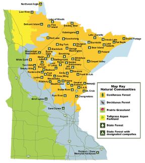
The Minnesota Department of Natural Resources has recently put up a new page on their website that directs cyclists to more information about the great mountain biking opportunities in Minnesota's State Forests.  These include over 2000 miles of forest roads and thousands of logging trails to explore.  The Mountain Biking in Minnesota State Forests page has information about what you need to know before you go, including links to Temporary State Forest Road Closures (updated weekly on Thursday after 2 p.m.), safety information, trail and road usage rules and State Forest Camping

At the bottom of the Mountain Biking in Minnesota State Forest page is a list of  State Forests that allow mountain biking, broken down by region.  Clicking on any of these links will take you to that State Forest's page and provide more details about location, trails, facilities and there is a link to a printable State Forest map showing trails and forest roads.

The Minnesota DNR reminds you, when biking in State Forests:
  • Mountain biking is permitted on all state forest roads and trails unless posted closed with the exception of Richard J. Dorer Memorial Hardwood State forest, where mountain bikes are permitted only on designated trails.
  • State forest roads can range from asphalt to gravel, maintained to minimal maintenance road surfaces.
  • Forest roads are used by cars, logging trucks, and other forest users (hikers, hunters, horseback riders, ATVs, and off-highway motorcycles).
  • All laws for public road use must be followed on state forest roads.
  • Watch out for logging trucks and heavy equipment in a state forest.
  • Check the state forest maps and Web site for road and trail closures.
  • Share the trail with others.
  • Stay on designated trails.
  • Keep right so others can pass.
  • Keep all pets on leash.
  • Obey traffic signs and rules.
  • Pack out all garbage and litter.
  • Respect adjoining landowners’ rights and privacy.
  • Warn other trail users when passing by giving an audible signal.
  • Let horses know you are passing. Some may be spooked by quiet bikers or inline skaters.
  • Overnight camping and campfires are permitted only on designated campsites.
  • Do not leave campfires unattended.
  • Enjoy the beauty of wild plants and animals, but leave them undisturbed for all to enjoy.

Thanks to the Minnesota Department of Natural Resources for making this information easily accessible so we may explore the beauty of our State Forests by bike.

Click here for a complete printable listing of  Minnesota State Forest mountain biking opportunities.  To order a State Forest map, contact the Minnesota DNR Information Center.

Phone:  651-296-6157 or 888-646-6367
Email:   info.dnr@state.mn.us
Address:  500 Lafayette Road
St. Paul, MN 55155-4040

7/18/2013

Bike Fun Finder: An Easy Way to Share, Find & Join Bike Events in Your Area


Are you leading a group ride, attending an upcoming bike event or looking to join a ride in your area?  There is a new app for that, it's called Bike Fun Finder.  This is a free app that is available for both Android and iPhone.  It started as an idea among friends Lance Poehler, Nathan Frost and Tim Neuwerth in Portland to help cyclists keep track of all of the "bike fun" in their area.  The app makes it easy to create, publicize, find and even track bike events in your area once they've started so you can join in on the fun.

Software engineer, Lance Pohler came up with the idea on a trip to San Francisco, "I really wanted to go on a bike ride. I was aware of a ride called the Butterlap, but not much more. I ended up not getting out for any bike fun solely because I wasn't 'in the know'. I figured there had to be a better way."  When he got home, he started working on his idea and later partnered up with his friends.  To learn more about how this app turned from an idea into a useful tool for cyclists, listen to this episode of the Sprocket Podcast.  E132 – Lance Poehler, Nathan Frost & Tim Neuwerth: Bike Fun Finder

The Bike Fun Finder will show a calendar of rides in your area.

iPhone
Android

Use it to create and update your own rides and get the word out.

Android
Android

iPhone

Search for rides by keyword, type and city.

Android
Android


iPhone

If you missed the start of a ride and one of the ride participants is tracking it, you can "live" track it and find out where the group is and join in.

iPhone

While word about Bike Fun Finder is just starting to spread, there are not a lot of listings for the Twin Cities area and around Minnesota yet, that should soon change.  They know about it in Portland, cyclists there use if often and listings of rides are being updated daily.  Minnesota being the "Bike Friendly State" is sure to soon follow suit.

The Bike Fun Finder app can be downloaded for free on the Google Play Store and the iTunes App Store.


Follow Bike Fun Finder on Twitter @BikeFunFinder and "Like" on Facebook for updates and new release details.

7/13/2013

Product Review: Camelbak Podium Water Bottles

I've tried all kinds of water bottles over the last few years and after using the Camelbak Podium water bottle, I've learned that not all water bottles are created equally.  The complaints I've had about the standard cycling water bottle are that they leak, they affect the taste of the water and the minor inconvenience of opening and closing the valve cap.  Camelbak's Podium water bottle line eliminates all of these problems.


The Podium line of water bottles comes in two sizes, a 21 ounce and a 24 ounce and fits in any bike water bottle cage.  For me, the 21 ounce bottle is a perfect fit and provides plenty of clearance for easy access due to the tight front triangle of my mountain bike frame.  If you prefer an insulated bottle to keep your water cold longer on those hot days, there is the Podium Chill (21 oz.) and the Podium Big Chill (25 oz.).  Each bottle is made from a proprietary blend of  BPA-free polypropylene and lined with CamelBak's HydroGuard to prevent bacteria buildup.  No more plastic taste or odor to affect the quality of your water or sports drink.


Besides taste not being affected by these bottles, my favorite feature of the Podium is the self-sealing Jet Valve.  With this valve there is no more opening, closing or leaking like on the pop-top style bottles when hydrating on-the-fly.  With a simple squeeze of the bottle, the Jet Valve opens and provides a high flow of water and immediately closes when you are finished.  Simply place the nozzle between your lips, open your mouth and give it a squeeze.  No more dripping down the front of your jersey or shirt.  For storage there is a rotary valve under the nozzle that can be used as a secondary lock out.  Keep it in the closed position to prevent leaks and spills in your bike bag, cooler, etc.

Twist the rotary valve to lock for storage.

The Camelbak Podium is easy to clean, each bottle is top-rack dishwasher safe.  Or if you prefer to wash it by hand, simply put a drop of dish soap in it and fill with hot water, give it a shake and squeeze.


When it comes to price on the Camelbak Podium bottles, they're going to cost a little more than the standard pop-top water bottle, but the design and convenience of the Jet Valve cap and the taste-free polypropylene construction more than make up for it.  The 21 oz. bottle usually runs around $9 and the 24 oz, $10.  The insulated Chill versions cost a little more with the 21 oz. at $12 and the 25 oz. at $14.


In conclusion, the Camelbak Podium water bottle line is a welcome change from the old.  These bottles, in my opinion, are the best I've used.  Since buying a couple of them, I have a cupboard full of old water bottles that I no longer use because they just don't compare.  I highly recommend them for anyone from the casual cyclist to the serious racer, they're just that good.

Disclosure:  Camelbak did not supply these bottles, I purchased them on my own to try them out and had no intention of writing a review, but I was so impressed by how they performed I decided to.

7/06/2013

Mankato Area Mountain Bikers Offer New Trail Opportunities


The Mankato Area Mountain Bikers (MAMB), the southern Minnesota affiliate of the Minnesota Off-Road Cyclists (MORC) were offered two opportunities by Blue Earth County for the development of new singletrack trails in the Mankato area last fall.  It is MAMB's vision to build sustainable, environmentally friendly trails that make the most of natural terrain features, so members jumped at the chance to develop two new trails.  With the help of members and volunteers, these new trails are ready to ride*.

Fort LeHillier Trail

View Ft. LeHillier Trail in a larger map

On the southwest corner of the intersection of Co. Rd. 90 and MN Hwy 66 lies a section of land along the Blue Earth River Bottoms, not far from the Mount Kato Ski Area, that contains the Fort LeHillier Trail.  This area was the sight of the old Fort LeHillier built in 1700.  The area has long served as a canoe/boat launch with a large gravel parking lot that makes the small trail system very accessible.

Image Credit:  Clay Haglund

I spoke with MAMB Board Member (also one of the founders), Clay Haglund via email and he told me, "The plot was only a few acres large and we have nearly maxed it out to get approximately a mile and a half of trail.  I have GPS'd 2.1 miles linking up all the options for one full lap which requires re-riding some of the main loop a few times.  The trails are beginner level with some intermediate features mostly on "B" lines.  You will find tight, flowing singletrack with berms, rollers and a few added features like skinnies and a rock garden.  There is only about 40' of elevation change so no sustained climbing.  We didn't know how long we would have to wait for further trail building opportunities so this trail tries to have a little something for everyone and provide an area to practice the kind of skills that are not being addressed by Mankato's other current mountain bike offerings."  For more photos of the trail building efforts of volunteers and members visit the Fort LeHillier Trail Building photo album on their Facebook page.

Below is a great video of the trail from Jeff Hokeness of Mankato.


Trailwork is done on the 2nd and 4th Thursdays of the month at 6:00 pm and updates will be posted on the MAMB Facebook page.

Note*
Recent flooding has caused a closure of the Fort LeHillier Trail.  From the MAMB Facebook page, "Due to all the rain we have had recently causing the high river levels the trail is largely under water and severely damaged. Pictures will follow.  Please stay off the trail until it is dry. We will have updates regarding trail repairs."

Image Credit:  Clay Haglund


Rail Tie Trail


View Rail Tie Trail in a larger map

Image Credit:  MAMB
Not long after construction began on the Fort LeHillier Trail, Blue Earth County approached MAMB and offered them another opportunity to build a small beginner trail in the right of way that runs parallel to the paved Red Jacket Trail.  This short section of singletrack is about a mile long and is easily handled by the most novice of riders.  Visit their Facebook photo album Rail Tie Trail for more pictures of the trail building efforts.


Because of the quality and commitment of the work done by MAMB, local leaders and land managers are taking notice. In my correspondence with Clay, he also stated, "Local leaders in Mankato and Blue Earth county have been impressed enough by our work that we've recently been granted access to a much larger plot of land near the Kiwanis dog park at the junction of Hwy 14 & Hwy 169.  Survey and assessment of the land is underway with planned trail construction to begin late summer or fall.  This area is much larger than Fort LeHillier with a lot of potential for new trails along with a pump track and skills park.  Another project that has been in the works for several years in St. Peter before our club officially formed, is also in the final stages of approval which opens up another 400 acres of river bottom land that might support 10+ miles of trail...so stay tuned...we're just getting started!"

MAMB is a 501.C3 non-profit organization with currently free membership.  To join, "Like" them on Facebook or visit the MAMB website and get involved with rides or volunteering.  "In the future, as our trails expand, we hope to become a chapter of the IMBA which will entail members paying dues; of which a portion will go back into the club's account for trail building needs."


Stay up-to-date on MAMB news by reading the MAMBlog or subscribe via RSS.  For more information on the Mankato Area Mountain Bikers, send an email to join.mamb@gmail.com or call them at 507-327-7170.
Related Posts Plugin for WordPress, Blogger...