Showing posts with label Bike Infrastructure. Show all posts

1/25/2017

MPLS Winter Biking Is New Interactive Site for Twin Cities Bike Commuters


MPLS Winter Biking is an online resource launched a couple of days ago by Foundry, a software design & development agency based in Minneapolis, that allows bike commuters in the Twin Cities to report and view trail/road conditions.  It works for both desktop and mobile devices.  Users of site can rate and add comments to their reports by clicking the map for the road or trail they would like to inform other cyclists about.


MPLS Winter Biking is interactive using Google Maps with Bicycling routes highlighted and user submitted reports are color coded based on the 5 star rating system.  Reports indicate whether or not they contain an optional comment on the conditions.  Cyclists can zoom in to report for a specific road or trail and each report shows the date and time of  the submission.  To keep the map information current, user submitted reports are only 3 days old or less.  Over the last day and a half, a lot of new reports have been submitted detailing how the commuter conditions have changed with the new snow we have received.

Whether you're an avid or occasional bike commuter, put this resource to use by submitting your reports so that other cyclists can be in the know and plan their routes accordingly.  Your fellow cyclists will thank you.

10/16/2016

Old Cedar Avenue Bridge Now Open


The Old Cedar Avenue Bridge officially opened last Friday to bicyclists and pedestrians even though it has been traveled by them for the last week and a half.  This opening creates a vital link across the Minnesota River connecting the South Metro to the communities North of the River without a long roundabout detour East and West of the Eagan/Bloomington area.


I have biked this area for many years and it's really nice having a crossing over the river to the Bloomington area in which I can head anywhere in the Twin Cities via streets, trails and light rail.  Not only are mountain bikers enthused about this new crossing which leads to the Mendota Trail on the Eagan side of the river and the Minnesota River Bottoms Trail, but also road cyclists that wish to ride routes that include roads on both sides of the river.


Cyclists aren't the only ones enjoying this new crossing, I have seen many walkers, runners and bird enthusiasts taking advantage of access to the Wildlife Refuge they didn't have before.  The bridge is slated to remain open until the Spring of 2017 when it will close again for road construction in nearby areas reopening in the fall of  2017.


The parking lot at the base of the bridge on the Bloomington side opened last Friday as well.  Now users of the Minnesota Valley National Wildlife Refuge can park nearby and experience all that the Refuge has to offer.

8/19/2016

Getting To The Great Minnesota Get Together By Bike


Avoid traffic congestion and the high cost of parking at the Great Minnesota Get Together by riding your bike.  The Minnesota State Fair has free secure and monitored bike parking at three locations.  The bike corrals are located at the Como-Snelling Gate (#6),  Hoyt-Snelling Gate (#2) and Randall-Buford Gate (#17).  They remain open daily from 6 a.m. to midnight.  Click here to download a printable color map of the Minnesota State Fair.

Image Credit: Minnesota State Fair

For State Fair goers that may have a longer commute, they can park and lock their bikes at one of several Park & Ride lots and take the bus for free to and from the fair.  These Park & Ride locations include:
  •  Roseville Area High School East of Hamline on Co. Rd. B2.  Not available Tuesday, August 30th or Thursday, September 1st.
  •  MN Dept. of Education East of Target, north of Co. Rd. B. (Pascal St. & Commerce St.). 
  •  U of M Minneapolis Campus (Not available Thursday, September 1st).  Various surface lots near TCF Bank Stadium along 6th Street SE and 8th Street SE open at 8 a.m. daily. 4th Street Ramp opens 4 p.m. weekdays and 8 a.m. weekends & Labor Day.
  •  Bandana Square North side of Energy Park Drive, east of Snelling Avenue (Weekends and Labor Day only).
Park Free, Ride Free bus rides are available from 8 a.m. to midnight and buses leave approximately every 20 minutes.  For a map of the Park Free, Ride Free locations, click here.


For Nice Ride MN subscribers, there is a Nice Ride Station located near the MN State Fair.  The U of M St. Paul Student Center Station is on Buford Ave. and is a short walk to Gate 16 by the Transit Hub.  Use the new Nice Ride Bike Share app for station locations, bike/dock availability and to rent/unlock bikes.

Image Credit:  Ochen K. from Bike Racks - Minnesota State Fair on Vimeo

There are several resources available to plan out your bike route to the fair.   BikeEverywhere has a Bike to the State Fair map that shows on-road, bike path next to road and bicycle corridor trail routes leading to the fair.  Please note that Lot 3 on this map has been moved from Commonwealth Ave. and West Dan Patch Ave. to the Randall-Buford Gate (#17).  Bike Walk Move has a downloadable Bicycling & Walking Como Avenue map that shows off-street bike paths and recommended on-street bike routes leading to the State Fairgrounds.  Cyclopath is a great tool for route planning.  Simply enter the beginning and ending addresses and it will find a bike route that matches the way you ride.


Google Maps using Bicycling Directions is also another great way to plan your ride to the Great Minnesota Get Together.  Enter the starting and ending points on your PC or by using the Google Maps app on your smartphone and you will be given several route choices. When using your computer you can even choose to send the route to your Google connected smartphone.  The Google Maps app even has an option to enable voice guided turn-by-turn directions so you can keep your eyes on the road.

Don't get stuck in traffic or pay the $13 State Fair parking fee.  By biking to the fair or using the Park Free, Ride Free bus service you can save yourself some money, enjoy the ride and arrive close to an entrance gate.

PLEASE NOTE that neither the fair bike corrals nor the Park & Ride lots provide for secure storage of bike helmets.

    10/15/2014

    Pedal Hub Podcast Keeps Listeners Updated on Growing Twin Cities Bike Community

    http://www.mprnews.org/topic/pedal-hub
    Pedal Hub is a weekly podcast brought to you by Minnesota Public Radio and is hosted by owner of One On One Bicycle Studio Gene Oberpriller, Amber Dallman from St. Paul Women on Bikes and 30 Days of Biking founder Patrick Stephenson.  These 30 minute episodes cover a number of cycling topics, what's going on with cycling in the Twin Cities and include guest cycling enthusiasts providing interesting discussions.

    Image Credit: Banjo Brothers

    Pedal Hub started back in August and continues to gain new listeners with each new episode.  This podcast is for all cyclists, beginner or experienced and is full of useful information and insight into cycling in the Twin Cities.  Visit the Pedal Hub page on the MPR News website for new and past episodes.  Subscribe to Pedal Hub on iTunes or the RSS Podcast Feed.  Stay updated on Pedal Hub by following on Twitter.

    5/22/2014

    Google Maps Adds Elevation Profiles For Bicycling Directions

    Google Maps has added a new feature to their bicycling directions that now provides elevation profiles for bike routes.  Cyclists that are looking for an easy route with few hills or those who want to take on a hill climbing challenge can now tell the exact amount of elevation gain and loss for a specified route.  Google has yet to make an official announcement regarding this new feature, but after TechCrunch discovered it, Google has confirmed that it has been added.


    To use this feature, click on the directions icon and select a starting point and a destination with any points in between that you would like to add.  Next select the biking directions icon and a panel on the left side of the map will show distance, estimated travel time, route options and the elevation profile for each route.  In the elevation profile panel there is an option to hide or show bike paths.  To switch between routes, click on the desired route on the map or on the elevation profile panel.  You won't see an elevation profile for routes that are essentially flat.


    This new elevation profile feature is only available at the moment for desktop Google Maps and not any of their mobile Google Maps apps.  Hopefully Google will add it for mobile use in the future.

    8/23/2013

    Avoid Traffic Congestion and Parking Fees by Biking to the MN State Fair


    Avoid the traffic congestion hassle and the high cost of parking at the Great Minnesota Get Together by riding your bike to the fair.  The Minnesota State Fair has free secure and monitored bike parking at three locations.  The bike corrals are located at the Como-Snelling Gate (#6),  Hoyt-Snelling Gate (#2) and Commonwealth-West Dan Patch (#15).  They remain open daily from 6 a.m. to midnight.  Click here to download a printable color map of the Minnesota State Fair.

    Image Credit:  Ochen K. from Bike Racks - Minnesota State Fair on Vimeo
    For State Fair goers that may have a longer commute, they can park and lock their bikes at one of several Park & Ride lots and take the bus for free to and from the fair.  These Park & Ride locations include:
    • Roseville Area High School East of Hamline on Co. Rd. B2.
    • MN Dept. of Education East of Target, north of Co. Rd. B. (Pascal St. & Commerce St.).
    • U of M Minneapolis Campus (NOT AVAILABLE THURSDAY, AUG. 29)  Various surface lots near stadium along 5th and 6th Streets SE as well as 25th Avenue SE open at 8 a.m. daily. 4th St. Ramp opens 4 p.m. weekdays and 8 a.m. weekends & Labor Day. 
    • Bandana Square North side of Energy Park Dr., east of Snelling Ave.
    Park Free, Ride Free bus rides are available from 8 a.m. to midnight and buses leave approximately every 20 minutes.  For a map of the Park Free, Ride Free locations, click here.

    For Nice Ride MN subscribers, there are two Nice Ride Stations located near the MN State Fair. The U of M St. Paul Campus Station is located on Commonwealth Ave. near the Commonwealth-West Dan Patch gate and the U of M St. Paul Student Center Station is on Buford Ave. about a half mile walk from the Commonwealth-West Dan Patch gate.  Use the Spotcycle app for station locations and bike/dock availability.

    There are several resources available to plan out your bike route to the fair.   BikeEverywhere has a Bike to the State Fair map that shows on-road, bike path next to road and bicycle corridor trail routes leading to the fair.  Bike Walk Move has a downloadable Bicycling & Walking Como Avenue map that shows off-street bike paths and recommended on-street bike routes leading to the State Fairgrounds.  Cyclopath is a great tool for route planning and is available for the seven county metro area.  Simply enter the beginning and ending addresses and it will find a bike route that matches the way you ride and there is a Cyclopath app can be used with Android smartphones.

    Don't get stuck in traffic or pay the $12 State Fair parking fee.  By biking to the fair or using the Park Free, Ride Free bus service you can save yourself some money, enjoy the ride and arrive close to an entrance gate.

    PLEASE NOTE that neither the fair bike corrals nor the Park & Ride lots provide for secure storage of bike helmets.

    8/03/2013

    2013 Minnesota State Bicycle Map Now Available

    I saw this the other day on Twitter from Meet Minneapolis verifying that the long awaited 2013 Minnesota State Bicycle Map is finally available.  This is the first new statewide bicycle map produced by the Minnesota Department of Transportation since 2001.


    Last year MN/DOT requested feedback from cyclists who ride in Minnesota and more than 2000 responded stating what is most important to display on the new map.  MN/DOT's goal for the Statewide Bicycle Planning Study was to facilitate "the development of a new state bicycle map which provides a statewide picture of bicycle accommodations in Minnesota to make it easier for people to plan longer distance bicycle trips in the state".   

    The print version is now available for free and can be ordered from the Explore Minnesota website.  This new map includes Minnesota's bicycle-friendly roads but does not contain paved trails.  For maps of paved trails, visit any of the four Maps Links pages (Twin Cities Area, Southern MN, Central MN and Northern MN) on MN Bike Trail Navigator or the Bicycling in Minnesota Maps page on the MN/DOT website.  An electronic and printable version of the new statewide map should be available soon.


    Visit the Explore Minnesota website to get your free copy of the 2013 Minnesota State Bicycle Map.  Simply check the box illustrated in the screen capture image above, fill out the mailing information form and one will be sent to you.  While you are there, order some of the other free State Publications or Regional Publications  to assist you with planning bike rides around the state.

    7/27/2013

    Get the Most Out of Your Nice Ride MN Experience With Spotcycle


    Spotcycle is a convenient and useful app created by 8D Technologies for the purpose of  locating bike stations and bike & dock availability of bike share systems for 26 cities in the U.S. and 7 countries.  It can even be used to create and share personalized bike routes or search for routes created by other Spotcycle users.


    Here in the Twin Cities the Spotcycle app works great with our own bike share system, Nice Ride MN.   Nice Ride bikes are available for use 24 hours a day, 7 days a week from April to November with numerous locations scattered throughout the Twin Cities.  A subscription is required to use Nice Ride and they are available yearly for $65 and daily for $6.  Trip charges do occur if you use the bikes more than a half an hour, but with so many bike stations around town it's easy to stay under thirty minutes and incur no trip fees.  For more details on how Nice Ride MN works, click hereSign up for Nice Ride MN today and get rolling.


    Spotcycle is easy to set up, simply select a city and it will show all of the bike stations for your area either on a map or a list.


    In the list display, stations can be sorted alphabetically, by number of bikes or docks available or by distance from your location. Select from All, Bike or Dock for for station availability information.  Switch to map view by selecting the map icon.


    Search for stations that are nearby and list them alphabetically, by bikes available, docks available or by distance from your current location.  If you know the station name you can search by station.  A map view is available by selecting the map icon.


    Frequently used stations can be grouped in Favorites for quick access.


    View a favorite in list or map display by selecting that group.


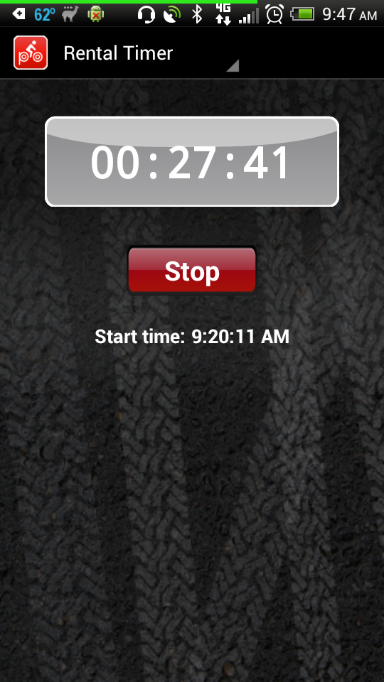
    Once you are ready to ride, keep track of your use time using the rental timer.


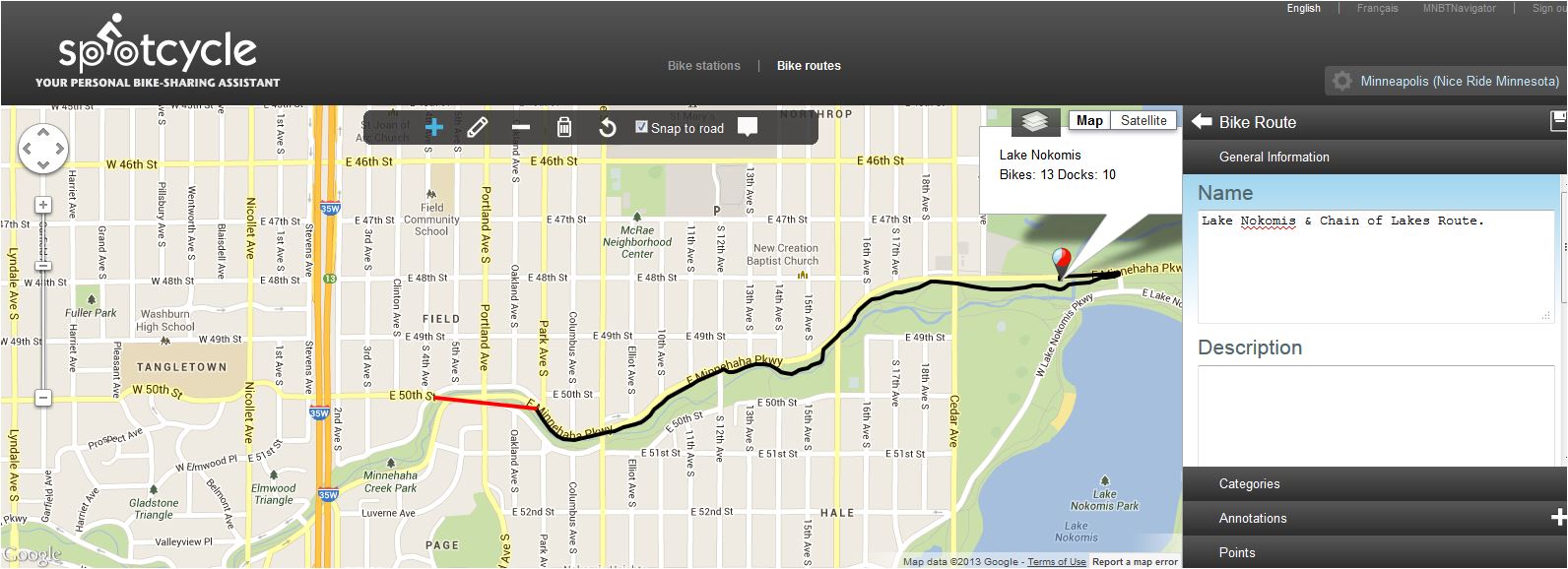
    Track and share your routes via Facebook, Twitter or email.  Keep your routes private if you choose or edit and share them later.  Annotations can be added along the way easily while tracking your route.


    Other Spotcycle user routes can be searched by Top Rated, Top Viewed, Browse By Category or Search Routes and bookmarked for later use.  One route I found particularly interesting was the "Minneapolis Original Garage Band" route.


    All the features of the Spotcycle app can be accessed by computer by registering and signing in to your Spotcycle account.  Route creation and editing can also be done from your computer.


    If you are a current Nice Ride subscriber or are thinking about becoming one, the Spotcycle app will definitely be a handy companion to enhance your Nice Ride experience.  Spotcycle is a free app and is available for Android, iPhone and Blackberry.  For questions about using the Spotcycle app, visit the Spotcycle FAQ page

    Stay up-to-date with Spotcycle by reading the Spotcycle Blog, following on Twitter or "Like" on Facebook.

    *Note:  All app screenshots in this post are from the Android app.  

    4/19/2013

    Zap Twin Cities: Encouraging and Rewarding Commuting By Bike in Minneapolis & St. Paul


    Zap Twin Cities is looking for St. Paul, Minneapolis and University of Minnesota commuters to get "Zapped".   The program was first implemented in 2012 by the University of Minnesota in January, then by Commuter Connection for Minneapolis in August and by St. Paul Smart Trips for St. Paul in September.  The goal of the program is to promote and increase bike commuting in the Twin Cities Metro area.  It provides incentives and rewards for those that already commute by bike and encourages others to start commuting by this method.  This is a completely free program and trip counts are automatically uploaded.  Participation in Zap Twin Cities will save you money on gas and parking, provide eligibility for great prizes and is a fun way to improve your health.


    Image Credit:  Joe Bielawa
    Image Credit:  Joe Bielawa
    Registering and getting tagged is easy.  A small RFID tag is installed in the spokes of your front wheel and then you just register online.  There are several locations to get tagged.  University of Minnesota students and staff can get tagged at the U of M Bike Center during normal business hours or at a mobile "Zap Zone" tent to pop up around campus this spring.  In Minneapolis you can bring your bike or front wheel to Commuter Connection located at the US Bank Plaza-Skyway 220 S. 6th St. Suite 230.  Commuter Connection will also have a booth at the Minneapolis Farmers Market and at events around Minneapolis throughout the spring and summer to get cyclists tagged and registered.  Minneapolis commuters can also get tagged at the Freewheel Midtown Bike Center on the Midtown Greenway or at Varsity Bike and Transit.  St. Paul commuters can bring their bike or front wheel to St. Paul Smart Trips located in the Alliance Bank Center at 55 E. 5th St. Suite 202.  Call ahead at 651-224-8555, ext. 23 or 24 and they will make sure they are in to tag your bike and get you registered when you stop by.


    Zap stations are strategically located around Minneapolis, the University of Minnesota Campus and in St. Paul.  As a cyclist passes by these Zap stations an audible beep and a flash of light will indicate that the ride has been registered.

    Minneapolis
    Minneapolis has 12 Zap readers (orange) and the University of Minnesota has 19 (yellow).

    St. Paul
    St. Paul has 7 Zap readers (blue) around the downtown area.

    Image Credit:  Joe Bielawa
    Image Credit:  Joe Bielawa
    To get zapped, a cyclist simply has to look where the Zap station antenna is pointing and pass by within 5 to 15 feet of the "Zap Zone", not on the sidewalk side or directly below the unit as indicated in the picture below.  The audible sound and light will indicate a successful Zap.  Riders only need to be zapped once per day to receive a round trip ride credit.


    The online web app keeps track of all of your Zap ride statistics so manually recording them is not necessary.  Log in at the Zap Twin Cities homepage to access how many trips you have logged in a given time period,  mileage totals, CO2 you have saved, gallons of gas saved, calories you have burned and if you are a member of a team you can see how yours compares to others.


    Zap Twin Cities rewards have been supported by local bike shops that donate prizes and the program will expand this year to include gift certificates to restaurants, movie theaters, and tickets to sporting events.  After logging ten rides cyclists automatically receive a prize.  Each month that a participant in the Zap Twin Cities program registers eight rides they are automatically entered into a drawing for valuable prizes.  Prizes are different every month, so get tagged, registered and start getting Zapped.  University of Minnesota students and staff that are UPlan Medical Program-covered participants can bike their way to health care savings by earning points for their Wellness Points Bank when they have 50 trips recorded as part of the Bicycle Commuter Program.


    Employers that would like to implement Zap Twin Cities as part of their own health and wellness program can contact the Commuter Connection and they will help get you started.  

    Stay up to date on the Zap Twin Cities program by liking them on Facebook or following on Twitter (@ZapTwinCities). 

    This program is a cooperative project of Commuter Connection, St. Paul Smart Trips, the University of Minnesota and Dero Bike Rack Company.
    Related Posts Plugin for WordPress, Blogger...