8/30/2013

Exploring the Minnesota Valley State Recreation Area by Mountain Bike


With over 29 miles of multi-use natural surface trail, the Minnesota Valley Trail runs from Chaska to Belle Plaine along the Minnesota River through the Minnesota Valley State Recreation Area.  I had never biked here before and it was on my list of places to ride this Summer so I headed down there one extremely hot Sunday afternoon.


My starting point was the trail access parking area off of Chestnut Blvd. just south of Chaska.  I would follow the river southwest to see where the day would take me.  The temperature would be hovering around 100° so I made sure to bring along plenty of water.  I figured at least a good portion of the ride wouldn't be too hot as the trail leads its way through shade of the wooded Minnesota River Bottoms.


My ride started out at the paved trail on the north end of the parking lot and I followed it west towards the Co. Rd. 41 bridge that leads across the river into Chaska.  I had to take a dirt trail down under the bridge to cross to the other side of the road and follow it to the start of the Minnesota Valley Trail.  Later I would come to find that the start of the trail was just across the street from gravel road that led into the parking lot.

Parking area trail access

Because of the heat I planned on riding just past the Thompson Ferry Landing and turning around.  This route would take me through the Gifford Lake Area, Carver Rapids, Louisville Swamp and Thompson Ferry.  The terrain would changed as I pass through each section to include wetlands, prairie, floodplain forests and wooded bluffs.


The trail starts out in the floodplain forest as it follows the river  through the Gifford Lake Area to a grassy section just southeast of Carver.


The prairie and wetlands section of trail in the Gifford Lake Area weaved its way in and out of the woods with slight elevation changes.  The Minnesota DNR has kept these sections mowed to make travel a little easier.


A little further along I entered the Louisville Swamp which soon brought me to a fork in the trail.  This intersection leads to a trailhead parking area on 145th St. off of Hwy. 169 or Carver Rapids.  To continue on my chosen route I followed the sign leading to Carver Rapids which brought me down a steep hill.


At the bottom of the hill was a bridge crossing for Sand Creek.  The creek was extremely low from the flood stage it had seen earlier this year.  I stopped for a short while to take in the view before moving on.


Riding through the Carver Rapids section was my favorite part of the trail.  It was heavily wooded with old growth river bottoms forest and the Johnson Slough made it seem like you were in bayou country.  The mosquitoes were so thick I kept moving at a brisk pace to avoid being eaten alive.  


As I reentered Louisville Swamp there were many more beautiful and tranquil sights to see as the trail as led me through fields, woods and past creeks with fallen timber.


Loose sand and silt from years of flooding from Louisville Swamp to the Thompson Ferry Landing slowed my roll a bit.  I maintained my pace exerting a little more energy than the previous more packed sections.  Soon I was at the Thompson Ferry Landing where I stopped for a rest and decided to travel a little further down the trail to see what it had in store.


I crossed the road to another parking area where the trail picked up again.  There was a picnic area here and a nice view of a big bend in the river.


From here the trail would lead through very sandy river bottoms that were almost impossible to ride through.  Some areas were packed enough to ride but most of it I had to hike-a-bike through.


Soon I came to a steep sandy ascent. I figured I would scale it to the top and check out the view high above the river before turning around for the ride back.  It was way too sandy and far too hot to even consider riding beyond this point.  I'm glad I made it this far because the view from up here was amazing.  The thick sand was perfect habitat for turtle nesting grounds.  There were depressions all over that had once contained eggs, but now the sand was littered with the broken shells and all those little guys had long since slid down the hill into the river.


On my way back I noticed several vantage points of the river that I had missed the first time around.  I stopped to get some photos and quickly got back to riding.  By now the temperature was 100°, my water was getting low and I just wanted to get back to my car and crank the air conditioning.  Round trip the ride was just short of 23 miles.


It was definitely a fun ride, while there were no real technical features there were some challenging sections. Because of its muti-use designation, the Minnesota Valley Trail isn't all just your traditional single or double track, the sandy river bottoms and grassy fields will slow you down a bit and give your legs a workout.  The scenery was the best part of visiting the Minnesota Valley State Recreation Area.  The floodplain forests, swamps, sloughs and creeks provided an ever changing landscape and some spectacular scenery for the entire length of the ride.  I look forward to coming back for a Fall change of colors ride.

I have created the Flickr photo set "Minnesota Valley State Recreation Area" that contains all of the day's ride photography and also a photo map showing the geo-location of every picture. 

The Minnesota Valley State Recreation Area is open 8:00 am to 10:00 pm 365 days a year.  For more information visit the MN DNR Minnesota Valley State Recreation Area home page.  For a printable map with facilities and features information, click here.

8/25/2013

Product Reveiw: Gup Gum Gear Custom Frame Bag


With all of the long distance gravel rides I have been doing, being able to carry the necessary water and the self-support tools I need put me in the market for a quality frame bag.  I did some research and came in contact with Neil Cary, whose small Twin Cities based company Gup Gum Gear handcrafts some great custom frame bags.  Neil has competed in many gravel grinder centuries and and his creations have been used by cyclists in the Arrowhead 135, TransIowa, TripleD, Tuscobia and numerous other gravel century races.  He uses what he makes and comes highly recommended.  With a resume' like that, a frame bag from Gup Gum Gear would be able to withstand whatever terrain I could throw at it, not to mention it would be convenient for around town or commuting.

I met with Neil to discuss the style of frame bag I was looking for and we talked about gravel riding, what features I would like implemented and color choices.  He instructed me on how to create a template of my frame's front triangle making sure to note the location of all cable stops and the derailleur.  Once he had the template he was ready to get started.

Image Credit:  Gup Gum Gear

This bag would be used primarily for long distance gravel but also for mountain biking and rides around town.  I needed it to be able to carry a hydration reservoir and all of my self-support tools (multi-tool, tire levers, CO2 cartridges & inflator, tire gauge and chain breaker).   The design I discussed with Neil would accomplish this and still leave room for carrying a light jacket or other small items I may need on a ride.

Neil told me that Gup Gum Gear frame bags are handcrafted from quality materials and come with the following features:
  •  XPak side panels (Black or Red)
  • YKK #8 Water Resistant Zippers
  • Ballistic Nylon perimeter 
  • Padded down tube and seat tube sections 
  • Large drive side compartment
  • Half height non-drive side map pocket
  • Hydration tube port

Image Credit:  Gup Gum Gear

One custom feature I wanted was a CO2 cartridge bandoleer in the non-drive side map pocket.  This would hold the cartridges secure and make room for my tools.  Neil hadn't had a request for this before but was up for the task.

He got to work on my bag and sent me these photos of its progress.

Image Credit:  Gup Gum Gear

The project was completed quicker than expected and I couldn't wait to strap it on my bike.  The fit was perfect, the Velcro straps held the bag very secure and now it was time to load it up with my tools and Hydrapak reservoir for a test ride.


One of the first places I tried it out at was the Minnesota River Bottoms.  While riding I didn't even notice I had a frame bag on, it didn't interfere and held all of my gear without jostling around.  Even with my small frame triangle the bag was big enough to hold my 70 oz. reservoir for hydrating on-the-fly.  The large YKK #8 zipper pulls did create some jingling but that was easily remedied by weaving paracord zipper pulls onto them to reduce the metal on metal contact.  They silenced the noise and made it easier to find and unzip the pockets while riding.


My new Gup Gum Gear frame bag has become a permanent fixture on my bike.  With or without the hydration reservoir in it, it's nice to have the extra cargo space for whatever I may need (water bottles, gloves, jacket, etc.).  This winter it will come in handy for carrying all of the necessary cold weather gear.  Changing weather conditions require the addition or removal of clothing layers and now I have a place to put them.

With the occasional rain or winter time slush, riding conditions aren't always dry ones.  I asked Neil about the water resistance of the materials used for the bag.  He told me, "All exterior fabrics on the bag have a dwr (durable water repellent) finish, so splashes and light rain won't be much concern.  Obviously the tube port on the top isn't going to be waterproof."


The quality and craftsmanship of the Gup Gum Gear frame bag was top notch and so was the personal customer service Neil provided.  They are not mass produced, each one is made to order for the specific dimensions of your frame and is a one-of-a-kind.  I would highly recommend any cyclist in the market for a custom frame bag to get in touch with Neil.  If you live in the Twin Cities area he can meet up with you for a beer or cup of coffee to discuss the specifics of your project.

For product information and a photo gallery of Gup Gum Gear designs, visit www.gupgum.com or the Gup Gum Gear Facebook page.  To contact Gup Gum Gear for more information or ordering, send an email to gupgumgear@gmail.com.

Disclosure:  Gup Gum Gear provided the review sample for this article, but offered no other form of compensation for this review.  

8/23/2013

Avoid Traffic Congestion and Parking Fees by Biking to the MN State Fair


Avoid the traffic congestion hassle and the high cost of parking at the Great Minnesota Get Together by riding your bike to the fair.  The Minnesota State Fair has free secure and monitored bike parking at three locations.  The bike corrals are located at the Como-Snelling Gate (#6),  Hoyt-Snelling Gate (#2) and Commonwealth-West Dan Patch (#15).  They remain open daily from 6 a.m. to midnight.  Click here to download a printable color map of the Minnesota State Fair.

Image Credit:  Ochen K. from Bike Racks - Minnesota State Fair on Vimeo
For State Fair goers that may have a longer commute, they can park and lock their bikes at one of several Park & Ride lots and take the bus for free to and from the fair.  These Park & Ride locations include:
  • Roseville Area High School East of Hamline on Co. Rd. B2.
  • MN Dept. of Education East of Target, north of Co. Rd. B. (Pascal St. & Commerce St.).
  • U of M Minneapolis Campus (NOT AVAILABLE THURSDAY, AUG. 29)  Various surface lots near stadium along 5th and 6th Streets SE as well as 25th Avenue SE open at 8 a.m. daily. 4th St. Ramp opens 4 p.m. weekdays and 8 a.m. weekends & Labor Day. 
  • Bandana Square North side of Energy Park Dr., east of Snelling Ave.
Park Free, Ride Free bus rides are available from 8 a.m. to midnight and buses leave approximately every 20 minutes.  For a map of the Park Free, Ride Free locations, click here.

For Nice Ride MN subscribers, there are two Nice Ride Stations located near the MN State Fair. The U of M St. Paul Campus Station is located on Commonwealth Ave. near the Commonwealth-West Dan Patch gate and the U of M St. Paul Student Center Station is on Buford Ave. about a half mile walk from the Commonwealth-West Dan Patch gate.  Use the Spotcycle app for station locations and bike/dock availability.

There are several resources available to plan out your bike route to the fair.   BikeEverywhere has a Bike to the State Fair map that shows on-road, bike path next to road and bicycle corridor trail routes leading to the fair.  Bike Walk Move has a downloadable Bicycling & Walking Como Avenue map that shows off-street bike paths and recommended on-street bike routes leading to the State Fairgrounds.  Cyclopath is a great tool for route planning and is available for the seven county metro area.  Simply enter the beginning and ending addresses and it will find a bike route that matches the way you ride and there is a Cyclopath app can be used with Android smartphones.

Don't get stuck in traffic or pay the $12 State Fair parking fee.  By biking to the fair or using the Park Free, Ride Free bus service you can save yourself some money, enjoy the ride and arrive close to an entrance gate.

PLEASE NOTE that neither the fair bike corrals nor the Park & Ride lots provide for secure storage of bike helmets.

8/20/2013

Product Review: Hydrapak Reversible Elite Reservoir w/ Shape Shift Technology

After seeing a video showing the unorthodox, real world testing of the Hydrapak Reversable Elite Reservoir with Shape Shift Technology, I had to try it out for myself.  Now I knew I would never put it through the rigorous testing that the Hydrapak guys did, but I figured with this kind of durability it would easily withstand the toughest mountain biking terrain without leaking.


Right out of the package I knew I was going to like this product.  It is full of features and had many of them I was looking for in a reservoir:

  • Reservoir, connectors and drink tube are all BPA and PVC free. 
  • Reservoir is completely reversible for easy cleaning and drying.
  • Plug & Play connection for fast tube attachment and removal with the reservoir remaining sealed.
  • Large opening for easy filling/emptying and adding ice cubes.
  • Secure top slider design for sealing the reservoir opening.
  • Shape Shift baffle to reduce jostling and to maintain a slim profile that stays engaged in rough terrain.
  • High flow bite valve with twist shut off.

I chose the 2 Liter Hydrapak Elite Reversible Reservoir for use with a custom frame bag handcrafted for me by Neil over at Gup Gum Gear.  Because of the small front triangle of my frame, the 2 L (70 oz.) model with dimensions of 6 ¾” x 12 ¼” would fit perfectly into my frame bag.  There is also a 3 L (100 oz.) model with dimensions of 6 ¾” x 16 ½” for larger frame bags, backpacks or hydration packs.

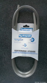
The reservoir comes with a 36 inch Hydraflex drink tube that works great for backpacks and hydration packs, but I would need something a little longer for use with a frame bag.  Hydrapak was kind enough to send out a 48 inch Elite Extended Tube for this review.  It was the perfect length for hydrating while riding, not too short or too long.   


Fully filled, the Hydrapak Elite Reservoir easily fit into my frame bag and the top slider closure could be maneuvered into position to zip the bag closed.  The Shape Shift baffle can be engaged before filling the reservoir to slim down its profile.


Next, I had to find a way to secure the Hydraflex tubing w/ bite valve in a way that was convenient and didn't interfere with riding.  The drink tube comes with a magnetic fastener which will work for attachment to a backpack strap on your chest, but since I was using it with a frame bag I attached it to the handlebars for quick access.  This was done by affixing a strip of Velcro to the bars and the tubing.  I took it for a 30 mile test run through the Minnesota River Bottoms to see if it would jostle free and it held securely for the full ride, even with all of the roots, rocks and log crossings.

The 2 L (70 oz.) capacity will provide me with enough water to stay hydrated on those longer rides, two to four hours depending on the temperature.  No more carrying multiple water bottles along and having to switch them out when they are empty and I can drink while both hands remain on the bars.


In conclusion, I found the Hydrapak Reversible Elite Reservoir to be quite durable, easy to use and best of all, it doesn't leak.  The slider top design seal makes it easy to fill and allows the reservoir to be completely turned inside out for cleaning and fast drying.  I really like the plug & play connection for the drink tube.  I can store the filled reservoir in the refrigerator or a cooler and connect the drink tube when I'm ready to ride.  The price points of $32.99 (2 L/70 oz.) and $34.99 (3 L/100 oz.) are in line with other popular reservoirs that don't have the features that Hydrapak has.  Overall, I am very happy with the performance and quality of the Hydrapak Reversible Elite Reservoir and I'll continue using it on all my rides to stay hydrated. 

Hydrapak stands behind all of their reservoirs with a lifetime warranty against defects that cause leaking, including the drink tube and bite valve.  For cyclists without a frame bag, consider this product for use in a backpack or to upgrade your current hydration pack. 

Disclosure:  Hydrapak provided the review sample for this article, but offered no other form of compensation for this review.

8/15/2013

La Crosse Area Bicycle Festival Celebrates Cycling in the Driftless Region Labor Day Weekend


Head down to La Crosse, WI this Labor Day Weekend for some of the best road cycling in the Midwest.  This is the weekend of the La Crosse Area Bicycle Festival which celebrates cycling in the scenic deep river valleys and bluffs of the Driftless Region of Southeastern Minnesota and West Central Wisconsin.  It will be a weekend of great cycling and fun family activities.  The festival begins Thursday, August 29th lasting through the weekend and wrapping up on Monday, September 2nd.

Image Credit:  www.bicyclelacrosse.com

The weekend kicks off on Thursday night with a Registration Packet Pick-Up Party at Pearl Street Brewery in La Crosse.  All weekend long a variety of rides with different routes and distances depart from Cameron Park in Downtown La Crosse.  Rides include:

Self-Guided Rides
  • 30-100 Mile Featured Road Rides
  • Sculpture Tour
  • Mountain Biking
  • Trail Rides
  • 200K Randonnée
  • Tandem & Recumbent Rides
  • Gravel Ride
Guided Rides
  • Heritage & Architectural Tours
  • Birding Ride
  • Coffee & Muffin Rides
  • Homemade Ice Cream Rides
  • Single Speed Ride

For a complete list, visit the Bicycle La Crosse website or download the Printable Schedule of Events.

The La Crosse Area Bicycle Festival coincides with the Downtown Sound  Music Festival which takes place on Saturday and Sunday from 2:00 to 10:00 pm.  The music festival will feature live entertainment on a bicycle powered stage!  For more information, visit the Downtown Sound Music Festival Facebook page.


Some great door prizes will be up for grabs on Sunday night for all registered Bicycle Festival participants who completed at least one ride and are 16 years of age or older.  The Grand Prize is a new Wyatt Bicycle and Bicycle Festival Jersey.


Online registration for the La Crosse Area Bicycle Festival is now available, click here.  If you are in need of lodging for the weekend, Bicycle La Crosse has set up a page of bicycle-friendly hotels in the area as well as links to more lodging and dining opportunities.
 
The La Crosse Area Bicycle Festival is sponsored by Mayo Clinic Health Systems.

8/08/2013

App Review: Runtastic Road Bike Pro


I have spent a lot of time testing out all of the features of many cycling apps available for the Android platform and none of them have the functionality and ease of use that the Runtastic Road Bike Pro has.  This app is jam-packed with everything a cyclist needs to track his or her performance and aid in navigation.  It has an easy to read display and all ride data is synced up with the user's online Runtastic account.  What more could you ask for?  This is why it has become my go-to app for all of my rides.

There is a free version of Runtastic Road Bike Pro, but it has limited functionality compared to the Pro version.  I highly recommend shelling out the $4.99 to unlock all of its useful features to get the best experience.  The Pro features that I use most often include Offline Maps, photo Geo-Tagging, Auto Pause and Voice Feedback.  For those with compatible smartphones, hardware integration is also available in the Pro version.  There is a Bluetooth speed & cadence sensor and heart rate monitor available for purchase on Amazon.

Features

Session

Starting and recording a session is easy, choose an activity and the type of workout that you will be doing and select "Start Workout".  The dashboard is configurable to display the values (duration, elevation, speed, etc.) you choose to view.  Note:  Make sure gps is enabled before using the app.


Ride Statistics

Once you have completed your ride and pressed stop on the dashboard, a session summary will display allowing input of how you were feeling, the ride surface, weather and any notes you would like to add.  In "Note", I usually add the precise actual statistics from my bike computer such as duration, distance, max speed and average speed for comparison.  Select "Done" to save your workout which can then be uploaded to your Runtastic account or shared via Facebook, Twitter, Google+ or email.


Now you can view all of the ride statistics from the session.  


  • The Main summary includes the details of your ride and the additional info input at the end of your session.
  • The Split Table displays the Fastest Section & Slowest Section, duration, speed and elevation for the distance (0.5, 1, 2, 5 and 10 miles) selected.
  • Graphs displays the elevation, speed, pace and heart rate (w/ compatible hardware) of the session.
  • Grade shows the time and distance spent uphill, flat and downhill in pie charts and also includes the average and max grades for uphill and downhill.  
  • Map will show your track with mileage markers, distance, duration and average speed of the session.  Colored traces can be chosen by default, pace, speed, elevation and grade to display on the map.

  •  Replay your session in 3D with Google Earth.

Maps

There are five map layers to choose from.  They include Google's Satellite & default maps, Terrain, Open Cycle Map and Open Street Map.  I prefer using the Open Cycle Map layer because it is designed for cyclists showing cycle routes and infrastructure.  I will sometimes switch to the Satellite map to locate structures or buildings along the way.

Default
Satellite
Terrain


Open Street
Open Cycle


Maps can be downloaded for offline use which is one of my favorite features.  I can select the size of the map location I am going to ride, download it and turn off my data to significantly save on battery.  Simply pinch and zoom to get the map area you want, select Download and your map will be ready for offline use.  This feature comes in handy when riding in remote areas with limited data coverage.


Routes

Routes can be created, searched or flagged on the Runtastic website after logging into your account.  Created and flagged routes will sync to your smartphone for later use.  I have created numerous routes to stay on course when using this app and I haven't missed a turn yet.  It's a great tool for navigation.


Once you have created, flagged or found a route using the search feature and would like to navigate using that route, select "Use This Route" and you are ready to begin your ride.  The course is laid out on the map with a bold red line to follow and a blue arrow and line to show your location and track.


When searching for routes within the app, you can display the results by Sport Type, Distance and Elevation Gain in a Results List or Map View.  Select the route for more details.

Voice Feedback

Voice feedback can be enabled in the settings for spoken in-ride statistics.  This feature can be set to be triggered by time and/or distance.  Interval statistics can include Sound at Kilometer/Mile, Distance, Duration, Pace, Speed, Calories and Heart Rate (w/ compatible hardware).  For the end of a session, Summary, Heart Rate Zones (w/ compatible hardware) and System Events can be selected for voice feedback.   


Photo Geo-Tagging

The ability to geo-tag* my photos on a map during a ride is a feature I really like.  It is very easy to do and can be done within the app.  In the settings menu there are options to pause your ride and enter notes to the photo during geo-tagging.  To take a picture during a session, tap the menu in the upper right corner and select "Take a picture".  This will open your default camera for the photo.  Once the photo has been taken, select the check mark if you are satisfied or select the back arrow if you are not and would like to take another.  *GPS must be enable on your phone.


At the end of your session when it is uploaded to the Runtastic website, all of your photos will be uploaded also.  Log into your Runtasitic account to view them on a map by scrolling your cursor over them or clicking them for a larger view. 


Conclusion

I have had quite a while to test Runtastic Road Bike Pro and play around with all of the features.  This is the best cycling app I have used in terms of functionality, accuracy, performance and ease of use.  Time and time again it has met or exceeded my expectations.  I can see why it is so highly rated in both Google Play and the iTunes app stores.  The $4.99 price tag is small in comparison to those expensive gps units that can do a lot of the same things.  I would recommend Runtastic Road Bike Pro for any cyclist that would like to use technology to aid in navigation and keep track of their ride performance.   


Runtastic Road Bike Pro is available for the Android and iPhone platforms.  For instructional videos on how to use all of the features for both iPhone and Android smartphones, click here.

Disclosure:  Runtastic provided the Runtastic Road Bike Pro app for this article, but offered no other form of compensation for this review.

*Note:  All app screenshots in this post are from the Android app.
Related Posts Plugin for WordPress, Blogger...