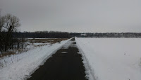
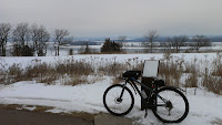
Cyclists can enjoy riding here year-round. In winter the city trails and the Mississippi River Regional trail are kept plowed clearing the way for the cold weather cyclist.
 |
| River Dike Trail |
 |
| Mississippi River Regional Trail |
The city's loop trail is about 10 miles and will take you around the edges of town.
The trip around Hastings that I most often take starts at Schaar's Bluff-Spring Lake Park Reserve in Nininger. It follows a route along the Mississippi River Regional Trail, the River Dike Trail, past Lock & Dam #2, though town (normally it would go through Levee Park, but a detour is in place due to bridge construction) and along the scenic loop. From there I continue on to C.P. Adams Park, Vermillion Falls Park and Vermillion River Linear Park before turning around and heading back to my starting point. There is some beautiful scenery along the way and several nice elevation changes to give you a workout on your ride. A small parking lot is located on Co. Rd. 47 and Pine Street if you prefer to do this route in reverse.
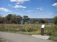
The City of Hastings trail system has some of the most scenic views in the area. You will want to bring your camera to capture some of the sights along the way.
Atop the hill overlooking the River Dike Trail
The River Dike Trail
Crossing the gorge by the Minnesota Veteran's Home
Veiws of the gorge at Vermillion Falls Park
Vermillion Falls
Mississippi River Regional Trail
Schaar's Bluff-Spring Lake Park Reserve
To help plan your Hastings bike trip, there are several resources you can go to for route information. For a free map of the Hastings Trail System, visit the Information and Publication Request page of the Hastings Area Chamber of Commerce & Tourism Bureau and check the Hiking/Biking box. A City of Hasting Parks & Trails Map is also available for download. To find maps on RideWithGPS or MapMyRide, login to your account and do a route search of the Hastings area to see a list of rides by other cyclists. These sites can also be used to create your own route through the Hastings area. I occasionally use RideWithGPS to map out gravel road rides south of town and Cue Sheet for Android as a guide to stay on course.
I am fortunate to live nearby and I bike the Hastings area year-round. My frequent visits give me the opportunity to see the change of seasons along the trails. Fall is my favorite time to ride here, the views of the Mississippi River Valley are amazing. Experience bike friendly Hastings, you won't be disappointed.


No comments:
Post a Comment