7/30/2012

Repairs Underway on Cannon Valley Trail


The Cannon Valley Trail opened its closed segment from the Welch Station to the Red Wing Trailhead on July 28th, but there are still repairs being made.  Heavy rainfall in June caused extensive damage resulting in closure of this segment and the effects can still be seen along the trail.  Shoulder repair, replacement of asphalt that was washed away, placement of a bridge that became dislodged and culvert repair are just a few of the things that continue to be worked on.


Large sections of asphalt needed to be replaced in several locations and many of the bridges also needed asphalt repair due to washouts on both sides of them.


Sand and mud that washed over the trail has been removed and by the size of the piles left behind the trail must have been covered pretty deep in some areas.


It appeared that most of the significant damage was in the first 1/3 of  the trail segment stating from the Welch Station heading east to Red Wing.  Trail crews are still making repairs during weekdays, so keep an eye out for them and be prepared to stop or go around them.  There are still several areas that are being prepared for paving and are filled with gravel, so slow down and use caution at these sections.


Bike Trail Picture of the Day - 7/30/12


Trail washout repairs underway

Taken:  7/30/12

Location:  Cannon Valley Trail
Welch to Red Wing Segment
Near Welch, MN

7/28/2012

Bike Trail Picture of the Day - 7/28/12


Morning ride along the Minnesota River

Taken 7/28/12

Location:  Mendota Trail
Fort Snelling State Park
Somewhere between Mendota & Eagan, MN

Full Length of Cannon Valley Trail to Open July 28th

The entire length of the Cannon Valley Trail from Cannon Falls to Red Wing is set to reopen on Saturday, July 28th.  The trail leading from the Cannon Falls Trailhead  to the Cannon Valley Trail has also reopened for use. 

There are still stretches of the trail that are unpaved and filled in with crushed rock, so riders should use caution when traveling across these sections.  Further asphalt, trail shoulder and ditch repair will continue for the next few weeks on weekdays but will not affect weekend trail usage.  Riders may be asked to walk their bikes around some of these construction areas and should use caution when passing repair crews or equipment.

7/25/2012

Bike and Walk to the Ballpark on Sunday, July 29th


Be one of  a 1000 cyclists and walkers to Target Field on Sunday, July 29th with tickets and cheer on the Twins as they take on the Cleveland Indians for the Bike and Walk to the Ballpark promotion.  This event is sponsored by the Minnesota Twins, the Minnesota Department of Transportation and Optum.  Participants will receive a free gift bag which includes a "Bike and Walk to the Ballpark" drawstring bag, a Twins water bottle and Twins chapstick.

Target Field will have additional bike racks available and there will be a bike corral near the Cedar Lake Trail on Glenwood by Parking Ramp A.

To receive your free gift bag, print out the "Bike and Walk to the Ballpark" voucher and present it along with your game ticket at the Optum booth on the Promenade outside Gate 14 between 11:00 am and 1:15 pm.

Go by bike and "Go Twins!".

7/23/2012

Minnesota River Bottoms West Segment in Great Shape

If you haven't been mountain biking in the Minnesota River Bottoms west segment recently, get out there.  The trails are dry and in great shape.  With the exception of the sandy areas between Nine Mile Creek and the swing bridge, the trails are very fast.


The only other thing that may slow you down is when you reach the Nine Mile Creek crossing.  The water level has dropped quite a bit from a couple of weeks ago and with the washout of the creek bank, the lower section of steps on the east side have broken away from the main part of the staircase.  Expect to step in some mud boarding the ferry raft.  If you are feeling a little more adventurous, you can head north along the creek bank to the old fallen tree.  The receding water level has made it possible to cross here once again.  


Once on the other side of the creek, you will see that you will have better visibility and some freedom from the stinging nettles because the trail has been mowed from here to the Bloomington Ferry Unit parking lot.  No more getting wet from the morning dew on the tall grasses or guessing where the trail goes when traveling through the thick stuff.


Navigating through the wooded sections has become a little easier too, with the mowing of the trail.  The trails are very fast with the dry conditions, so get out there and race from one end to the other and back to put your skills and speed to the test.


Keep your eyes scanning ahead of you for others using the trails.  Deer have been following the trails a lot, I  saw many deer tracks along the way.  I kicked up this 4 point buck with a velvet rack that didn't hear me coming until I got close to him as he walked along the trail.  On my return from the Bloomington Ferry Unit parking lot I had a spotted fawn cross the trail in front of me.  There were a lot of squirrels jumping out of my way as I raced through the wooded sections, too.

Bike Trail Picture of the Day - 7/23/12


I spooked this little 4-pointer

Taken 7/23/12

Location:  Minnesota River Bottoms
Bloomington, MN

7/21/2012

City of Minneapolis Announces Two Trail Detour Updates

The City of Minneapolis has announced its plan for two closures of popular trails in the city for repairs to preserve trail surface and to relocate a rail line that crosses a trail.  Closures with detours will include the Cedar Lake Trail and the Midtown Greenway Hiawatha Spur.  The information below was sent out to Bicycle and Pedestrian Update Subscribers via e-mail.

Two Trail Detour Updates:
Cedar Lake Trail
Beginning Tuesday, July 24, 2012, the Cedar Lake Trail will experience periodic closures between Royalston Ave N and Hwy 100. The closures are needed to perform joint sealing and sand sealing work and will help preserve the trail surface for at least 10 years. The closures will occur in four stages, each lasting 1-2 days. Three detours will be marked to facilitate the four closures.
Stage 1 – July 24-25
Royalston Ave N to Luce Line Trail – Follow marked detour via Glenwood Ave N, Cedar Lake Rd N and Luce Line Trail/Bryn Mawr Meadows.
Stage 2 – July 26
Luce Line Trail to Kenilworth Trail – Follow marked detour via Luce Line Trail/Bryn Mawr Meadows, Cedar Lake Rd N/S, S Wayzata Blvd, Cedar Lake Rd S and Cedar Lake Pkwy.
Stage 3 – July 30
Kenilworth Trail to Cedar Lake Pkwy – Follow same detour as Stage 2.
Stage 4 – July 31
Cedar Lake Pkwy to Hwy 100 – Follow marked detour via Ewing Ave S, France Ave S, Forest Rd, Parklands Rd, Cedarwood Rd, Parkwoods Rd and W 23rd St.
Midtown Greenway Hiawatha Spur
On Wednesday, July 25 and Thursday, July 26, 2012, the Midtown Greenway Hiawatha Spur will be closed. The Hiawatha Spur is the short, at-grade trail segment just east of Hiawatha Ave S. The closure is needed to relocate a rail line that crosses the trail. Please follow the marked detour via the Sabo Bridge. 
Note: The work dates listed above are tentative and may change if weather conditions are poor.
For a map of major closures and detours that may affect Minneapolis bicyclists and pedestrians, visit the Bicycling Detour page.
Thank you for your continued patience with these closures,
City of Minneapolis Bicycle and Pedestrian Section

If you would like to subscribe to the Bicycle and Pedestrian Update, visit http://www.minneapolismn.gov/bicycles/email-updates  and follow the instructions.

7/15/2012

Bike Trail Picture of the Day - 7/15/12


Aqua Jesters on the move

Taken 7/15/12

Location:  Near Thomas Beach
Lake Calhoun
Chain of Lakes Byway District
Grand Rounds Scenic Byway
Minneapolis, MN

7/12/2012

Minnesota River Bottoms West Segment: Mid Summer Trail Report


I hadn't been to the Minnesota River Bottoms since the end of May and I decided to make the trip and see how the trail conditions were after the flooding.  I also wanted to investigate if there was still a crossing at Nine Mile Creek, if there were any downed trees blocking the trail that needed removal and how overgrown the underbrush had become.  Was the network of trails still passable or did you need a machete to get through?  There wasn't much current information on the condition of the trails on MORC's Trail Conditions Forum other than it was "Dry", "lushly overgrown with grasses at points" and "plenty of loose sand in the center section", so I wanted to see for myself and to let others know.

Trail conditions in the refuge change throughout the year so I prepared accordingly.  Workout pants for the  overgrown underbrush, grasses and stinging nettles, proper footwear, bug spray for the millions of mosquitoes that inhabit the area, sunscreen and water bottles.  I also made sure I brought along a spare tube, tire levers and a CO2 inflator in the event of a flat.

I started out from the Lyndale Avenue Minnesota Valley National Wildlife Refuge parking lot in Bloomington and headed west with my destination being the Bloomington Ferry Unit parking lot.


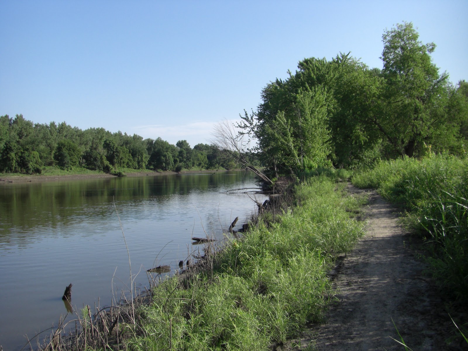
It wasn't very long into the ride before I encountered the first downed tree in the trail.  It was in the 11 Mile section of the trail, but a detour trail had already been established and getting around it was not a problem.  I continued on and it was smooth going all the way to Nine Mile Creek.

When I got to Nine Mile Creek I was pleasantly surprised to see that MORC had put in place the ferry crossing raft.  Earlier in the season, the only way to get from one side to the other was to pick up your bike and walk it across a large fallen tree.  With the recent flooding, the log pile at the east end of the tree was washed away making it a little more difficult to get onto it without getting wet.  After my ride I spoke with Pat Sorensen from Penn Cycle and he informed me that MORC had placed the raft two weeks earlier.


The Mile 12 section of the trail has some tall grassy fields and lengthy loose sand areas that require some legwork and balance to get through.  Wider tires for floatation will help make easier work of the sandy sections.  Fat tire bikers will be able to roll through these areas with ease.


Mile 13 is a little easier going and a faster ride, but still has some areas of tall grasses and weeds.


Mile 14 contains more of the same with the exceptions of a downed tree in the trail (detour already in place) and a longer section of very tall grasses in a field area that makes it hard to see the trail when you are speeding through.


Mile 15 to the Bloomington Ferry Unit is smooth sailing.  The trail is pretty clear and wide without the tall, thick underbrush and grasses of earlier mile marker segments.  You can get your speed up through this last mile of trail.  Take a break at the Bloomington Ferry Unit kiosk or take in a view of the river from the bike/pedestrian bridge and head back to the start.


My overall impression, it's still a fun, fast ride.  Just go there prepared with the proper clothing, gear and plenty of mosquito repellent.  The trails are completely passable and the only really challenging areas continue to be the loose, sandy sections and the low visibility areas through the tall grassy fields.

*Update note: This report in 7/15/12 from the MORC Trail Conditions Page for the Minnesota River Bottoms.  "Trail was in good shape on Thursday, BEFORE it was mowed. Now that it's been cut it's even BETTER! Almost makes me wish there was a "like" button.
There is a downed tree that's very rideable near the old foundation between the swing bridge and the ferry. Watch out coming down because if you ride too far from the root-ball it's a steep drop. Found out that you can endo really good there
."

Related Posts Plugin for WordPress, Blogger...